
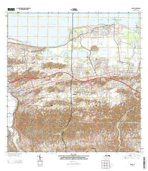
~ Manati PR topo map, 1:20000 scale, 7.5 X 7.5 Minute, Historical, 2013
Manati, Puerto Rico, USGS topographic map dated 2013.
Includes geographic coordinates (latitude and longitude). This topographic map is suitable for hiking, camping, and exploring, or framing it as a wall map.
Printed on-demand using high resolution imagery, on heavy weight and acid free paper, or alternatively on a variety of synthetic materials.
Topos available on paper, Waterproof, Poly, or Tyvek. Usually shipping rolled, unless combined with other folded maps in one order.
- Product Number: USGS-5964462
- Free digital map download (high-resolution, GeoPDF): Manati, Puerto Rico (file size: 42 MB)
- Map Size: please refer to the dimensions of the GeoPDF map above
- Weight (paper map): ca. 55 grams
- Map Type: POD USGS Topographic Map
- Map Series: US Topo
- Map Verison: Historical
- Cell ID: 27402
- Datum: North American Datum of 1983
- Map Projection: Transverse Mercator
- Map Cell Name: Manati
- Grid size: 7.5 X 7.5 Minute
- Date on map: 2013
- Map Scale: 1:20000
- Geographical region: Puerto Rico, United States
Neighboring Maps:
All neighboring USGS topo maps are available for sale online at a variety of scales.
Spatial coverage:
Topo map Manati, Puerto Rico, covers the geographical area associated the following places:
- Tierras Nuevas Poniente Comunidad - Sabana Seca - Residencial Enrique Catoni - Pugnado Afuera - Brasilia - Triovegabajeno - Tierras Nuevas Poniente - Atenas - Residencial Enrique Zorilla - Vega Baja - Felix Cordova Davila - Coto Norte - Las Flores - El Pueblito - Los Molinos - Río Abajo - El Alto - Villa del Rosario - Barriada San Jose - El Pulguero - Villa Real - Campo Alegre - Extension O'Neill - Coto Sur - San José - Altagracia - Miranda Comunidad - Monte Carlo - San Salvador - Colinas del Marques - Los Naranjos - Coto Norte Comunidad - Villa Evangelina - Palo Alto - Luchetti - Vega Baja Zona Urbana - Jardines de Monaco - Manatí Zona Urbana - Villa Rosa - La Granja - Córdova Dávila - Ojo de Agua - Miranda - Sandin - Manatí - La Trocha - Valles de Manati - Boquillas - La Glorieta - Combate
- Map Area ID: AREA18.518.375-66.5-66.375
- Northwest corner Lat/Long code: USGSNW18.5-66.5
- Northeast corner Lat/Long code: USGSNE18.5-66.375
- Southwest corner Lat/Long code: USGSSW18.375-66.5
- Southeast corner Lat/Long code: USGSSE18.375-66.375
- Northern map edge Latitude: 18.5
- Southern map edge Latitude: 18.375
- Western map edge Longitude: -66.5
- Eastern map edge Longitude: -66.375


