
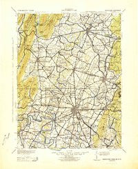
~ Hagerstown MD topo map, 1:125000 scale, 30 X 30 Minute, Historical, 1943, updated 1943
Hagerstown, Maryland, USGS topographic map dated 1943.
Includes geographic coordinates (latitude and longitude). This topographic map is suitable for hiking, camping, and exploring, or framing it as a wall map.
Printed on-demand using high resolution imagery, on heavy weight and acid free paper, or alternatively on a variety of synthetic materials.
Topos available on paper, Waterproof, Poly, or Tyvek. Usually shipping rolled, unless combined with other folded maps in one order.
- Product Number: USGS-5931223
- Free digital map download (high-resolution, GeoPDF): Hagerstown, Maryland (file size: 8 MB)
- Map Size: please refer to the dimensions of the GeoPDF map above
- Weight (paper map): ca. 55 grams
- Map Type: POD USGS Topographic Map
- Map Series: HTMC
- Map Verison: Historical
- Cell ID: 65623
- Scan ID: 461748
- Imprint Year: 1943
- Woodland Tint: Yes
- Aerial Photo Year: 1939
- Edit Year: 1943
- Datum: NAD27
- Map Projection: Polyconic
- Map published by United States Army Corps of Engineers
- Map published by United States Army
- Map published by United States Department of War
- Keywords: Overedge
- Map Language: English
- Scanner Resolution: 600 dpi
- Map Cell Name: Hagerstown
- Grid size: 30 X 30 Minute
- Date on map: 1943
- Map Scale: 1:125000
- Geographical region: Maryland, United States
Neighboring Maps:
All neighboring USGS topo maps are available for sale online at a variety of scales.
Spatial coverage:
Topo map Hagerstown, Maryland, covers the geographical area associated the following places:
- Brightwood Acres - Highlands of Monroe - Flook Farm - Falling Waters - Edenville - Spring Hill Estates - McIntyre Estates - Pleasant View - Blueberry Heights - Gristmill Hill - Orchard Hills - Tammany Manor - Mount Moriah - Cavetown - Roxbury - Friendship Park - Conococheaque - Woburn Estates - Beaver Creek Estates - Knepper - Richmond Furnace - Tabb (historical) - Eldridge - Duffield - Green Village - Weller Farm - Jugtown - Cedar Hills - Zullinger - Chewsville - Zentmyer - Wolfsville Crossing - Waterloo - Woodmoor - Five Forks - Forsythe - Lynch Estates - Country Squire Estates - Fairgreen Acres - Deer Lodge Mobile Home Park - Mount Lena - Fairview Mill - Dutchtown - Spring Mills - Sandy Hook - Robinwood - Marlowe - Johnston - Sylvan Grove - Cedar Lawn - Londontowne - Heritage Estates - Breathedsville - Ringgold - Wagners Crossroads - Dogtown - Leitersburg - Mason and Dixon - Red Bridge - Doub Meadow - Turkeyfoot - Bittle - Nunnery - Saint James - Oaklett Estates - North Mountain - Eastland Hills - Greenvale Village - Greensburg - Claylick - Greencastle - El Rancho Mobile Home Park - Woodcrest Village - Charlestown - Mount Pleasant - Blank - Buena Vista Springs - Jugtown - Fox Hill - Middlepoint - Greystone Hills - Grimes - Bear Lick - Potomac Woodlands - Hedgesville - Hill Village - Bessemer - Kemps - Dickey - Kent Estates - Fairplay Farms - Colonial Park - Myersville - Meeting House Overlook - Little Georgetown - Halfway Manor - Kasiesville - Cress - Garfield - Burtner
- Map Area ID: AREA4039.5-78-77.5
- Northwest corner Lat/Long code: USGSNW40-78
- Northeast corner Lat/Long code: USGSNE40-77.5
- Southwest corner Lat/Long code: USGSSW39.5-78
- Southeast corner Lat/Long code: USGSSE39.5-77.5
- Northern map edge Latitude: 40
- Southern map edge Latitude: 39.5
- Western map edge Longitude: -78
- Eastern map edge Longitude: -77.5


