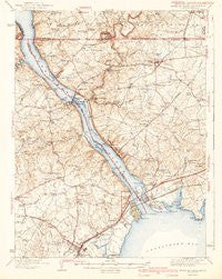
~ Havre De Grace MD topo map, 1:62500 scale, 15 X 15 Minute, Historical, 1942, updated 1942
Havre De Grace, Maryland, USGS topographic map dated 1942.
Includes geographic coordinates (latitude and longitude). This topographic map is suitable for hiking, camping, and exploring, or framing it as a wall map.
Printed on-demand using high resolution imagery, on heavy weight and acid free paper, or alternatively on a variety of synthetic materials.
Topos available on paper, Waterproof, Poly, or Tyvek. Usually shipping rolled, unless combined with other folded maps in one order.
- Product Number: USGS-5930413
- Free digital map download (high-resolution, GeoPDF): Havre De Grace, Maryland (file size: 9 MB)
- Map Size: please refer to the dimensions of the GeoPDF map above
- Weight (paper map): ca. 55 grams
- Map Type: POD USGS Topographic Map
- Map Series: HTMC
- Map Verison: Historical
- Cell ID: 55167
- Scan ID: 461521
- Imprint Year: 1942
- Visual Version Number: 1
- Survey Year: 1940
- Datum: NAD27
- Map Projection: Polyconic
- Map published by United States Geological Survey
- Map Language: English
- Scanner Resolution: 600 dpi
- Map Cell Name: Havre de Grace
- Grid size: 15 X 15 Minute
- Date on map: 1942
- Map Scale: 1:62500
- Geographical region: Maryland, United States
Neighboring Maps:
All neighboring USGS topo maps are available for sale online at a variety of scales.
Spatial coverage:
Topo map Havre De Grace, Maryland, covers the geographical area associated the following places:
- Locksley Manor - Darlington - Oak Grove - Greenhurst - Clearview - Robin Acres - Conowingo Mobile Home Park - Paradise Heights - Frank - Aberdeen - Bald Friar (historical) - Woodside - Woodlawn - Pleasant Grove - Perry Point - Quaker Hills - Theodore - Carpenter Point - Bald Hill - Sylmar - Fair Hill - Loch Leven - Richardsmere - Homestead Mobile Home Estates - Mount Pleasant View - Craigtown - Jacks Corner - Carsins - Octararo (historical) - Garland - Timber Grove Mobile Home Park - Colony Acres - Level Terrace - Blythedale - Susquehanna River Hills - Lafayettes Crossing - Millers Store - Aikin - Topeka East - Lapidum Heights - Halls Trailer Villa - Poplar Point - Chestnut Point Estates - Burkley Manor - Rock Springs - Chesapeake Acres - Hopewell Village - Proctors Seat - Darlington Mobile Home Park - Misty Meadows - Jenkins Corner - Vinegar Hill - Sturgill - Carsins Run Estates - Jackson Mill Farms - Moxley - Oakington Manor - Four Star Mobile Home Park - Mount Pleasant Acres - Rowlandsville Heights - Kilby Corner - Woodlyn Heights - Mount Zoar - Sunset Gardens - Meadowbrook - Sherwood Homes - West Rock Station - Liberty Grove - Silver Acres - Hillside - Flintville (historical) - Happy Knoll - Hillview Farms - The Bluffs - Clearview Court - Oakwood - Burns Corner - Gallions Corner - Havre de Grace Heights - Freemont - Deer Creek Estates - Octararo Lakes - Colora - Glenn Heights - Spring Meadow - Hopewell Manor - Dol Ray - Maxa Woods - Harrisville - Castleton - North Hills - Osborne - Windemere Estates - Rock - Concord - Port Heights - Grace Harbour - Rising Sun - Rowlandsville - Running Brook Park
- Map Area ID: AREA39.7539.5-76.25-76
- Northwest corner Lat/Long code: USGSNW39.75-76.25
- Northeast corner Lat/Long code: USGSNE39.75-76
- Southwest corner Lat/Long code: USGSSW39.5-76.25
- Southeast corner Lat/Long code: USGSSE39.5-76
- Northern map edge Latitude: 39.75
- Southern map edge Latitude: 39.5
- Western map edge Longitude: -76.25
- Eastern map edge Longitude: -76


