
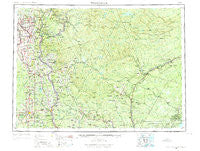
~ Woodstock ME topo map, 1:250000 scale, 1 X 2 Degree, Historical, 1959, updated 1975
Woodstock, Maine, USGS topographic map dated 1959.
Includes geographic coordinates (latitude and longitude). This topographic map is suitable for hiking, camping, and exploring, or framing it as a wall map.
Printed on-demand using high resolution imagery, on heavy weight and acid free paper, or alternatively on a variety of synthetic materials.
Topos available on paper, Waterproof, Poly, or Tyvek. Usually shipping rolled, unless combined with other folded maps in one order.
- Product Number: USGS-5689398
- Free digital map download (high-resolution, GeoPDF): Woodstock, Maine (file size: 19 MB)
- Map Size: please refer to the dimensions of the GeoPDF map above
- Weight (paper map): ca. 55 grams
- Map Type: POD USGS Topographic Map
- Map Series: HTMC
- Map Verison: Historical
- Cell ID: 69109
- Scan ID: 461041
- Imprint Year: 1975
- Woodland Tint: Yes
- Datum: Unstated
- Map Projection: Transverse Mercator
- Map published by United States Geological Survey
- Map Language: English
- Scanner Resolution: 600 dpi
- Map Cell Name: Woodstock
- Grid size: 1 X 2 Degree
- Date on map: 1959
- Map Scale: 1:250000
- Geographical region: Maine, United States
Neighboring Maps:
All neighboring USGS topo maps are available for sale online at a variety of scales.
Spatial coverage:
Topo map Woodstock, Maine, covers the geographical area associated the following places:
- Kings Grove - Harvey - Hodgdon - New Limerick - Phair - Easton Center - Bishop - Grass Corner - Carys Mills - Easton Station - Cote Corner - Jackins Settlement - Westfield - Sawyer Corner - Brown Corner - Limestone - Mars Hill - Houlton - Robinson - Sharp - Houghtonville - East Lyndon - Littleton - Linneus - Grimes Mill - Hodgdon Corners - Parkhurst - Blaine - Easton - Fort Fairfield - Morey Brow - Monticello - Powers Corner - Maysville - McShea - Fairmount - Bridgewater - Sugar Hill - Jewells Corner - Stevensville - Goodwin - Maine - Snow Settlement - Washburn Junction - Campbell - Roberts - Goodrich - East Hodgdon - Bridgewater Corner - Madawaska - Green Ridge - Hurd - Hill - Somers Corner - McGraw - Four Corners - Morris Corner - Maple Grove
- Map Area ID: AREA4746-68-66
- Northwest corner Lat/Long code: USGSNW47-68
- Northeast corner Lat/Long code: USGSNE47-66
- Southwest corner Lat/Long code: USGSSW46-68
- Southeast corner Lat/Long code: USGSSE46-66
- Northern map edge Latitude: 47
- Southern map edge Latitude: 46
- Western map edge Longitude: -68
- Eastern map edge Longitude: -66


