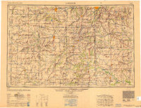
~ Lawrence KS topo map, 1:250000 scale, 1 X 2 Degree, Historical, 1950, updated 1950
Lawrence, Kansas, USGS topographic map dated 1950.
Includes geographic coordinates (latitude and longitude). This topographic map is suitable for hiking, camping, and exploring, or framing it as a wall map.
Printed on-demand using high resolution imagery, on heavy weight and acid free paper, or alternatively on a variety of synthetic materials.
Topos available on paper, Waterproof, Poly, or Tyvek. Usually shipping rolled, unless combined with other folded maps in one order.
- Product Number: USGS-5689262
- Free digital map download (high-resolution, GeoPDF): Lawrence, Kansas (file size: 14 MB)
- Map Size: please refer to the dimensions of the GeoPDF map above
- Weight (paper map): ca. 55 grams
- Map Type: POD USGS Topographic Map
- Map Series: HTMC
- Map Verison: Historical
- Cell ID: 68869
- Scan ID: 707440
- Imprint Year: 1950
- Woodland Tint: Yes
- Aerial Photo Year: 1945
- Datum: NAD27
- Map Projection: Transverse Mercator
- Shaded Relief map: Yes
- Map published by United States Geological Survey
- Map published by United States Army Corps of Engineers
- Map published by United States Army
- Map Language: English
- Scanner Resolution: 508 dpi
- Map Cell Name: Lawrence
- Grid size: 1 X 2 Degree
- Date on map: 1950
- Map Scale: 1:250000
- Geographical region: Kansas, United States
Neighboring Maps:
All neighboring USGS topo maps are available for sale online at a variety of scales.
Spatial coverage:
Topo map Lawrence, Kansas, covers the geographical area associated the following places:
- Oasis Mobile Home Park - Burlingame - Jeffreys - Bismark Grove - Ransomville - Aubry - Ballard - Huber - Strasburg - Glenlock - Kincaid - Auburn - Botham Mobile Home Park - Virginia - Four Corners - Wakarusa - Wingate - Cadmus - Stilwell - Arthur - Farlinville - Hume - Green Acres Park Mobile Home Park - Lane - Goodrich - Hillsdale - Cornland - Wellsville - Belton - Louisburg Manufactured Home Estates - Hadsell - Lake Winnebago - Block - Wagstaff - Wea - Waverly - Gunn City - New Strawn - Neosho Falls - Harveyville - Linn Valley - Cedar - Peoria - La Cygne Corner - Halls Summit - Wyoming (historical) - Boicourt - Chiles - Henson - Sni Mills - Maple Leaf Mobile Home Park - Foster - Monticello - Critzer - Drexel - Lyndon Station - Quenemo - Flinn - Scranton - Swissvale - Prairie Village - Rucker - New Santa Fe - Paola Mobile Home Park - Hickman Mills - Peru (historical) - Watson - Le Loup - De Soto - Lone Elm - Mayesburg - Williamsburg - Bush City - Pleasant Gap - Louisburg - Elm - South Lee - Osage City - Selma - Weaver - Pomona - Geneva - Gaslight Village Mobile Home Park - Wolfe (historical) - Olson Acres - Coachlight Village Mobile Home Courts South - Grandview Mobile Home Park - Indian Springs - Cause Prairie (historical) - Reynard (historical) - Silkville - Harrelson - Neosho Rapids - Holmes Park - Worden - Longview - Hillside Mobile Home Park - South Drexel - Cockrell - Everett
- Map Area ID: AREA3938-96-94
- Northwest corner Lat/Long code: USGSNW39-96
- Northeast corner Lat/Long code: USGSNE39-94
- Southwest corner Lat/Long code: USGSSW38-96
- Southeast corner Lat/Long code: USGSSE38-94
- Northern map edge Latitude: 39
- Southern map edge Latitude: 38
- Western map edge Longitude: -96
- Eastern map edge Longitude: -94

