
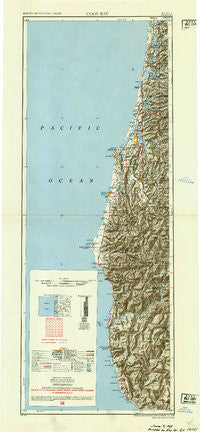
~ Coos Bay OR topo map, 1:250000 scale, 2 X 1 Degree, Historical, 1954, updated 1954
Coos Bay, Oregon, USGS topographic map dated 1954.
Includes geographic coordinates (latitude and longitude). This topographic map is suitable for hiking, camping, and exploring, or framing it as a wall map.
Printed on-demand using high resolution imagery, on heavy weight and acid free paper, or alternatively on a variety of synthetic materials.
Topos available on paper, Waterproof, Poly, or Tyvek. Usually shipping rolled, unless combined with other folded maps in one order.
- Product Number: USGS-5680627
- Free digital map download (high-resolution, GeoPDF): Coos Bay, Oregon (file size: 19 MB)
- Map Size: please refer to the dimensions of the GeoPDF map above
- Weight (paper map): ca. 55 grams
- Map Type: POD USGS Topographic Map
- Map Series: HTMC
- Map Verison: Historical
- Cell ID: 320754
- Scan ID: 283313
- Imprint Year: 1954
- Aerial Photo Year: 1945
- Datum: NAD27
- Map Projection: Transverse Mercator
- Shaded Relief map: Yes
- Map published by United States Army Corps of Engineers
- Map Language: English
- Scanner Resolution: 600 dpi
- Map Cell Name: Coos Bay
- Grid size: 2 X 1 Degree
- Date on map: 1954
- Map Scale: 1:250000
- Geographical region: Oregon, United States
Neighboring Maps:
All neighboring USGS topo maps are available for sale online at a variety of scales.
Spatial coverage:
Topo map Coos Bay, Oregon, covers the geographical area associated the following places:
- Shorewood - Estabrook - Winchester Bay - Sixes - Norway - Riverton - Plum Trees - Glasgow - Jerrys Flat (historical) - Bullards - Saunders Lake - Libby - Coquille - Laurel Grove - Eastside - Barview - Coos City (historical) - Westlake - Bay Park - McKinley - Hauser - Templeton - Denmark - Pistol River - Millington - Nesika Beach - Bagnell Ferry - Broadbent - Siltcoos - Gardiner - Englewood - Arago - Acme - Ophir - Parkersburg - Cranberry Corners - Leneve - Lampa (historical) - Charleston - Canary - Winterville - Harbor - North Beach - Umpqua City (historical) - North Bend - Glenada - Coaledo - Gaylord - Myrtle Point - Bridge - Knoxville (historical) - Port Orford - Lakeside - Agness - Dunes City - Illahe - Florence - Randolph - Carpenterville - Gravelford - Empire - Gold Beach - Green Acres - Lee (historical) - Kings Landing (historical) - Coos River - Dellwood - Cushman - Sumner - Lakeport (historical) - Etelka (historical) - Crown Point - Hunter Creek - Tenmile - Cedar Point - Langlois - Prosper - Fourmile - Fairview - Brookings - Coos Bay - Eckley (historical) - Willard (historical) - Wedderburn - Delmar - Cooston - Bandon - Bunker Hill - Bancroft - Dew Valley - Allegany - Powers - Reedsport - East Gardiner
- Map Area ID: AREA4442-125-124
- Northwest corner Lat/Long code: USGSNW44-125
- Northeast corner Lat/Long code: USGSNE44-124
- Southwest corner Lat/Long code: USGSSW42-125
- Southeast corner Lat/Long code: USGSSE42-124
- Northern map edge Latitude: 44
- Southern map edge Latitude: 42
- Western map edge Longitude: -125
- Eastern map edge Longitude: -124


