
~ Baird Inlet AK topo map, 1:250000 scale, 1 X 3 Degree, Historical, 1951, updated 1953
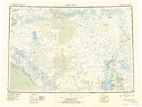
Baird Inlet, Alaska, USGS topographic map dated 1951.
Includes geographic coordinates (latitude and longitude). This topographic map is suitable for hiking, camping, and exploring, or framing it as a wall map.
Printed on-demand using high resolution imagery, on heavy weight and acid free paper, or alternatively on a variety of synthetic materials.
Topos available on paper, Waterproof, Poly, or Tyvek. Usually shipping rolled, unless combined with other folded maps in one order.
- Product Number: USGS-5660400
- Free digital map download (high-resolution, GeoPDF): Baird Inlet, Alaska (file size: 22 MB)
- Map Size: please refer to the dimensions of the GeoPDF map above
- Weight (paper map): ca. 55 grams
- Map Type: POD USGS Topographic Map
- Map Series: HTMC
- Map Verison: Historical
- Cell ID: 68658
- Scan ID: 360570
- Imprint Year: 1953
- Datum: NAD27
- Map Projection: Universal Transverse Mercator
- Map published by United States Geological Survey
- Map Language: English
- Scanner Resolution: 600 dpi
- Map Cell Name: Baird Inlet
- Grid size: 1 X 3 Degree
- Date on map: 1951
- Map Scale: 1:250000
- Geographical region: Alaska, United States
Neighboring Maps:
All neighboring USGS topo maps are available for sale online at a variety of scales.
Spatial coverage:
Topo map Baird Inlet, Alaska, covers the geographical area associated the following places:
- Togiaratsorik (historical) - Tagayarak (historical) - Nunapitchuk - Chefornak - Tuntutuliak - Eek - Kuskovak - Akulurak - Shevenak (historical) - Takechak (historical) - Aklut - Kvigatluk (historical) - Nunachuk - Atmautluak - Newtok - Ukak - Kasigluk - Kanloyak (historical) - Apokak - Unakak (historical) - Nvortulermiut (historical) - Kinak (historical) - Cheching (historical) - Chimekliak - Napakiak (historical) - Chakchak (historical) - Nightmute - Kinak (historical) - Yakchilak (historical) - Aguikchuk
- Map Area ID: AREA6160-165-162
- Northwest corner Lat/Long code: USGSNW61-165
- Northeast corner Lat/Long code: USGSNE61-162
- Southwest corner Lat/Long code: USGSSW60-165
- Southeast corner Lat/Long code: USGSSE60-162
- Northern map edge Latitude: 61
- Southern map edge Latitude: 60
- Western map edge Longitude: -165
- Eastern map edge Longitude: -162


