
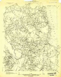
~ Beckford NC topo map, 1:48000 scale, 15 X 15 Minute, Historical, 1906
Beckford, North Carolina, USGS topographic map dated 1906.
Includes geographic coordinates (latitude and longitude). This topographic map is suitable for hiking, camping, and exploring, or framing it as a wall map.
Printed on-demand using high resolution imagery, on heavy weight and acid free paper, or alternatively on a variety of synthetic materials.
Topos available on paper, Waterproof, Poly, or Tyvek. Usually shipping rolled, unless combined with other folded maps in one order.
- Product Number: USGS-5658820
- Free digital map download (high-resolution, GeoPDF): Beckford, North Carolina (file size: 12 MB)
- Map Size: please refer to the dimensions of the GeoPDF map above
- Weight (paper map): ca. 55 grams
- Map Type: POD USGS Topographic Map
- Map Series: HTMC
- Map Verison: Historical
- Cell ID: 51089
- Scan ID: 161713
- Survey Year: 1906
- Datum: Unstated
- Map Projection: Unstated
- Map published by United States Geological Survey
- Keywords: Nonstandard Press Run; Overedge
- Map Language: English
- Scanner Resolution: 600 dpi
- Map Cell Name: Beckford
- Grid size: 15 X 15 Minute
- Date on map: 1906
- Map Scale: 1:48000
- Geographical region: North Carolina, United States
Neighboring Maps:
All neighboring USGS topo maps are available for sale online at a variety of scales.
Spatial coverage:
Topo map Beckford, North Carolina, covers the geographical area associated the following places:
- Snow Hill - Icaria - Cannon Ferry - Keys Crossroads - Lloyd Crossroads - Peach - Savage - Walton Crossroads - Sunbury - Mintonsville - Hobbsville - Acorn Hill - Folly Fork - Muddy Cross - Hoflers Fork - Carter - Joppa - Greens Fork - Ryland - Kellogs Fork - Powell Crossroads - Trotville - Sign Pine - Wardville - Belvidere - Selwin - Mitchells Fork - Hickory Crossroads - Mount Rose - Chowan - Silver Springs - Beckford Junction - Gliden - Eason Crossroads - Hutson Corner - Old Chapel Crossroads - Sandy Cross - Flat Branch
- Map Area ID: AREA36.536.25-76.75-76.5
- Northwest corner Lat/Long code: USGSNW36.5-76.75
- Northeast corner Lat/Long code: USGSNE36.5-76.5
- Southwest corner Lat/Long code: USGSSW36.25-76.75
- Southeast corner Lat/Long code: USGSSE36.25-76.5
- Northern map edge Latitude: 36.5
- Southern map edge Latitude: 36.25
- Western map edge Longitude: -76.75
- Eastern map edge Longitude: -76.5


