
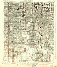
~ Watts CA topo map, 1:24000 scale, 7.5 X 7.5 Minute, Historical, 1937, updated 1942
Watts, California, USGS topographic map dated 1937.
Includes geographic coordinates (latitude and longitude). This topographic map is suitable for hiking, camping, and exploring, or framing it as a wall map.
Printed on-demand using high resolution imagery, on heavy weight and acid free paper, or alternatively on a variety of synthetic materials.
Topos available on paper, Waterproof, Poly, or Tyvek. Usually shipping rolled, unless combined with other folded maps in one order.
- Product Number: USGS-5658141
- Free digital map download (high-resolution, GeoPDF): Watts, California (file size: 10 MB)
- Map Size: please refer to the dimensions of the GeoPDF map above
- Weight (paper map): ca. 55 grams
- Map Type: POD USGS Topographic Map
- Map Series: HTMC
- Map Verison: Historical
- Cell ID: 395938
- Scan ID: 301254
- Imprint Year: 1942
- Survey Year: 1923
- Datum: NAD
- Map Projection: Polyconic
- Map published by United States Geological Survey
- Map Language: English
- Scanner Resolution: 600 dpi
- Map Cell Name: Watts
- Grid size: 7.5 X 7.5 Minute
- Date on map: 1937
- Map Scale: 1:24000
- Geographical region: California, United States
Neighboring Maps:
All neighboring USGS topo maps are available for sale online at a variety of scales.
Spatial coverage:
Topo map Watts, California, covers the geographical area associated the following places:
- Athens - Hacienda Village - Willowbrook - Watts - Imperial Courts - Firestone Park - Willow Brook - Florence - Graham - Avalon Gardens - Wingfoot - Lynwood - Jordan Downs - South Gate - South Los Angeles - Huntington Park - Walnut Park - Pueblo Del Rio Public Housing - Nickerson Gardens - Nadeau
- Map Area ID: AREA3433.9-118.3-118.2
- Northwest corner Lat/Long code: USGSNW34-118.3
- Northeast corner Lat/Long code: USGSNE34-118.2
- Southwest corner Lat/Long code: USGSSW33.9-118.3
- Southeast corner Lat/Long code: USGSSE33.9-118.2
- Northern map edge Latitude: 34
- Southern map edge Latitude: 33.9
- Western map edge Longitude: -118.3
- Eastern map edge Longitude: -118.2


