
~ Punta Puerca PR topo map, 1:20000 scale, 7.5 X 7.5 Minute, Historical, 1957, updated 1982
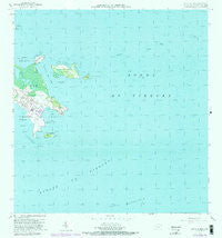
Punta Puerca, Puerto Rico, USGS topographic map dated 1957.
Includes geographic coordinates (latitude and longitude). This topographic map is suitable for hiking, camping, and exploring, or framing it as a wall map.
Printed on-demand using high resolution imagery, on heavy weight and acid free paper, or alternatively on a variety of synthetic materials.
Topos available on paper, Waterproof, Poly, or Tyvek. Usually shipping rolled, unless combined with other folded maps in one order.
- Product Number: USGS-5654956
- Free digital map download (high-resolution, GeoPDF): Punta Puerca, Puerto Rico (file size: 25 MB)
- Map Size: please refer to the dimensions of the GeoPDF map above
- Weight (paper map): ca. 55 grams
- Map Type: POD USGS Topographic Map
- Map Series: HTMC
- Map Verison: Historical
- Cell ID: 36642
- Scan ID: 362220
- Imprint Year: 1982
- Woodland Tint: Yes
- Visual Version Number: 1
- Photo Revision Year: 1982
- Aerial Photo Year: 1977
- Edit Year: 1982
- Field Check Year: 1943
- Datum: Puerto Rico
- Map Projection: Polyconic
- Map published by United States Geological Survey
- Map Language: English
- Scanner Resolution: 600 dpi
- Map Cell Name: Punta Puerca
- Grid size: 7.5 X 7.5 Minute
- Date on map: 1957
- Map Scale: 1:20000
- Geographical region: Puerto Rico, United States
Neighboring Maps:
All neighboring USGS topo maps are available for sale online at a variety of scales.
Spatial coverage:
Topo map Punta Puerca, Puerto Rico, covers the geographical area associated the following places:
- Punta Puerca - Piragua de Adentro - Machos Barrio - Punta Figueras - Piragua de Afuera - Punta Medio Mundo - Bahía de Puerca - Cabra de Tierra - Roca Descubridor - Ceiba Municipio - Cabeza de Perro - Cabeza de Perro - Las Lavanderas del Este - Cayo Piñerito - Piragua de Afuera - Isla Cabras - Pasaje Medio Mundo - Bajo Chinchorro del Sur - Puerto Medio Mundo - Las Lavanderas del Oeste - Cayo Cabritas - Isla Piñeros - Las Lavanderas - Cabezo de Perro - Bajo Chinchorro del Norte - Piragua de Adentro
- Map Area ID: AREA18.291666718.1666667-65.625-65.5
- Northwest corner Lat/Long code: USGSNW18.2916667-65.625
- Northeast corner Lat/Long code: USGSNE18.2916667-65.5
- Southwest corner Lat/Long code: USGSSW18.1666667-65.625
- Southeast corner Lat/Long code: USGSSE18.1666667-65.5
- Northern map edge Latitude: 18.2916667
- Southern map edge Latitude: 18.1666667
- Western map edge Longitude: -65.625
- Eastern map edge Longitude: -65.5


