
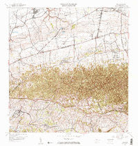
~ Moca PR topo map, 1:20000 scale, 7.5 X 7.5 Minute, Historical, 1964, updated 1967
Moca, Puerto Rico, USGS topographic map dated 1964.
Includes geographic coordinates (latitude and longitude). This topographic map is suitable for hiking, camping, and exploring, or framing it as a wall map.
Printed on-demand using high resolution imagery, on heavy weight and acid free paper, or alternatively on a variety of synthetic materials.
Topos available on paper, Waterproof, Poly, or Tyvek. Usually shipping rolled, unless combined with other folded maps in one order.
- Product Number: USGS-5654846
- Free digital map download (high-resolution, GeoPDF): Moca, Puerto Rico (file size: 24 MB)
- Map Size: please refer to the dimensions of the GeoPDF map above
- Weight (paper map): ca. 55 grams
- Map Type: POD USGS Topographic Map
- Map Series: HTMC
- Map Verison: Historical
- Cell ID: 76887
- Scan ID: 362162
- Imprint Year: 1967
- Woodland Tint: Yes
- Visual Version Number: 2
- Edit Year: 1964
- Survey Year: 1937
- Datum: Puerto Rico
- Map Projection: Polyconic
- Map published by United States Geological Survey
- Map Language: English
- Scanner Resolution: 600 dpi
- Map Cell Name: Moca
- Grid size: 7.5 X 7.5 Minute
- Date on map: 1964
- Map Scale: 1:20000
- Geographical region: Puerto Rico, United States
Neighboring Maps:
All neighboring USGS topo maps are available for sale online at a variety of scales.
Spatial coverage:
Topo map Moca, Puerto Rico, covers the geographical area associated the following places:
- Las Palmas - Vistas de Medina - San Antonio Comunidad - Comunidad Sabana - Villa de Espana - Sol y Mar - Aceitunas Comunidad - Aceitunas - Los Robles - San Antonio - Moca - Arenales - Moca Zona Urbana - Reparto Miraflores - Los Flamboyanes - Sector Florida - Riego (historical) - Villa Soto - Galateo Bajo - Rafael Hernández Comunidad - Corrales - Mora Comunidad - Cuba - Domencech - Comunidad Ramos - Mora - Moca Gardens - Mantilla - La Monserrate - Rafael Hernandez - Montaña - Capá - Sector Loma Santa - La Vega - Santiago - Mora - Jobos - Villa Deloamit - Cuatro Calles (historical)
- Map Area ID: AREA18.518.375-67.125-67
- Northwest corner Lat/Long code: USGSNW18.5-67.125
- Northeast corner Lat/Long code: USGSNE18.5-67
- Southwest corner Lat/Long code: USGSSW18.375-67.125
- Southeast corner Lat/Long code: USGSSE18.375-67
- Northern map edge Latitude: 18.5
- Southern map edge Latitude: 18.375
- Western map edge Longitude: -67.125
- Eastern map edge Longitude: -67


