
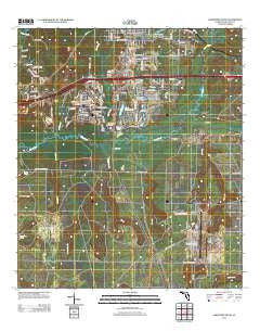
~ Crestview South FL topo map, 1:24000 scale, 7.5 X 7.5 Minute, Historical, 2012
Crestview South, Florida, USGS topographic map dated 2012.
Includes geographic coordinates (latitude and longitude). This topographic map is suitable for hiking, camping, and exploring, or framing it as a wall map.
Printed on-demand using high resolution imagery, on heavy weight and acid free paper, or alternatively on a variety of synthetic materials.
Topos available on paper, Waterproof, Poly, or Tyvek. Usually shipping rolled, unless combined with other folded maps in one order.
- Product Number: USGS-5648897
- Free digital map download (high-resolution, GeoPDF): Crestview South, Florida (file size: 23 MB)
- Map Size: please refer to the dimensions of the GeoPDF map above
- Weight (paper map): ca. 55 grams
- Map Type: POD USGS Topographic Map
- Map Series: US Topo
- Map Verison: Historical
- Cell ID: 10715
- Datum: North American Datum of 1983
- Map Projection: Transverse Mercator
- Map Cell Name: Crestview South
- Grid size: 7.5 X 7.5 Minute
- Date on map: 2012
- Map Scale: 1:24000
- Geographical region: Florida, United States
Neighboring Maps:
All neighboring USGS topo maps are available for sale online at a variety of scales.
Spatial coverage:
Topo map Crestview South, Florida, covers the geographical area associated the following places:
- North Okaloosa Medical Center Heliport - Honey Creek - Crestview Fire Department Station 5 - Titi Creek - Antioch Church - Juniper Creek - Duke Field (Eglin Air Force Base Auxiliary Number 3) - Live Oak Church - Pearl Creek - City of Crestview - Friendship Church - North Okaloosa Medical Center - Gopher Creek - Turkey Hen Creek - Crestview Country Club - Piney Woods Creek - King Branch - Trammel Creek - Dugan Pond - Canaan Church - Clyde Reese Pond - Mill Creek - North Okaloosa Fire Department Station 84 - Crain Pond - Lost Boy Pond - Eglin Air Force Base Fire Station Duke Field 3 - Silver Creek - Okaloosa County - Okaloosa Correctional Institution - Williams Branch - WCNU-AM (Crestview)
- Map Area ID: AREA30.7530.625-86.625-86.5
- Northwest corner Lat/Long code: USGSNW30.75-86.625
- Northeast corner Lat/Long code: USGSNE30.75-86.5
- Southwest corner Lat/Long code: USGSSW30.625-86.625
- Southeast corner Lat/Long code: USGSSE30.625-86.5
- Northern map edge Latitude: 30.75
- Southern map edge Latitude: 30.625
- Western map edge Longitude: -86.625
- Eastern map edge Longitude: -86.5


