
~ Smiley TX topo map, 1:125000 scale, 30 X 30 Minute, Historical, 1920
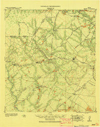
Smiley, Texas, USGS topographic map dated 1920.
Includes geographic coordinates (latitude and longitude). This topographic map is suitable for hiking, camping, and exploring, or framing it as a wall map.
Printed on-demand using high resolution imagery, on heavy weight and acid free paper, or alternatively on a variety of synthetic materials.
Topos available on paper, Waterproof, Poly, or Tyvek. Usually shipping rolled, unless combined with other folded maps in one order.
- Product Number: USGS-5638411
- Free digital map download (high-resolution, GeoPDF): Smiley, Texas (file size: 8 MB)
- Map Size: please refer to the dimensions of the GeoPDF map above
- Weight (paper map): ca. 55 grams
- Map Type: POD USGS Topographic Map
- Map Series: HTMC
- Map Verison: Historical
- Cell ID: 395858
- Scan ID: 128680
- Woodland Tint: Yes
- Visual Version Number: 1
- Survey Year: 1908
- Datum: Unstated
- Map Projection: Unstated
- Special Map: Yes
- Map published by United States Army Corps of Engineers
- Map Language: English
- Scanner Resolution: 600 dpi
- Map Cell Name: Smiley
- Grid size: 30 X 30 Minute
- Date on map: 1920
- Map Scale: 1:125000
- Geographical region: Texas, United States
Neighboring Maps:
All neighboring USGS topo maps are available for sale online at a variety of scales.
Spatial coverage:
Topo map Smiley, Texas, covers the geographical area associated the following places:
- Monthalia - Jakes Colony - Gillett - Smiley - Plummer Crossing - Oak Forest - Cestohowa - Cost - Bebe - Ecleto - Pandora - Gray Crossing - Dewville - Gruenau - Nopal - New Davy - Nixon - Pilgrim - Denhawken - Pawelekville - Nockenut - Leesville - Sample - Old Davy - Caddo - Kosciusko - Alum - Wrightsboro - Yokum - Stockdale - Schoolland - Garfield - Union - Harmony
- Map Area ID: AREA29.529-98-97.5
- Northwest corner Lat/Long code: USGSNW29.5-98
- Northeast corner Lat/Long code: USGSNE29.5-97.5
- Southwest corner Lat/Long code: USGSSW29-98
- Southeast corner Lat/Long code: USGSSE29-97.5
- Northern map edge Latitude: 29.5
- Southern map edge Latitude: 29
- Western map edge Longitude: -98
- Eastern map edge Longitude: -97.5


