
~ Georgetown SC topo map, 1:250000 scale, 1 X 2 Degree, Historical, 1974, updated 1978
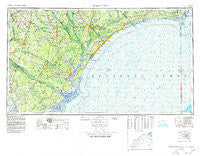
Georgetown, South Carolina, USGS topographic map dated 1974.
Includes geographic coordinates (latitude and longitude). This topographic map is suitable for hiking, camping, and exploring, or framing it as a wall map.
Printed on-demand using high resolution imagery, on heavy weight and acid free paper, or alternatively on a variety of synthetic materials.
Topos available on paper, Waterproof, Poly, or Tyvek. Usually shipping rolled, unless combined with other folded maps in one order.
- Product Number: USGS-5638375
- Free digital map download (high-resolution, GeoPDF): Georgetown, South Carolina (file size: 19 MB)
- Map Size: please refer to the dimensions of the GeoPDF map above
- Weight (paper map): ca. 55 grams
- Map Type: POD USGS Topographic Map
- Map Series: HTMC
- Map Verison: Historical
- Cell ID: 76862
- Scan ID: 262043
- Imprint Year: 1978
- Woodland Tint: Yes
- Photo Revision Year: 1978
- Aerial Photo Year: 1973
- Edit Year: 1978
- Datum: Unstated
- Map Projection: Transverse Mercator
- Map published by United States Geological Survey
- Map Language: English
- Scanner Resolution: 600 dpi
- Map Cell Name: Georgetown
- Grid size: 1 X 2 Degree
- Date on map: 1974
- Map Scale: 1:250000
- Geographical region: South Carolina, United States
Neighboring Maps:
All neighboring USGS topo maps are available for sale online at a variety of scales.
Spatial coverage:
Topo map Georgetown, South Carolina, covers the geographical area associated the following places:
- Midway - Jones Crossroads - Green Bay - Myrtle Beach - Freemont - Moore Crossroads - Kelley Heights - Salem Crossroads - Chapel Creek - Willie Towne - Muddy Creek Crossroads - Red Hill - Gourdin - Shady Forest - Little Town - Forney - Pawleys Plantation - Russellville - Kellehan Crossroads - Providence - Howells - North Santee - Saw Mill - Laurel Hill Plantation - Fleet - Golf View Plantation - Swamp Fox - North Myrtle Beach - Cane Patch - Stokes (historical) - Cochran Town - Harristown - Ocean Pines - Burkett Landing - Harper Crossroads - Gravel Hill (historical) - Palmetto Estates - Keys Field - Cordesville - Suttons - The Forest - Mary - Marysville - Hannah - Henry - Pitch Landing - McKenzie Crossroads - Pee Dee Crossroads - Colonial Estates - Maple Crossroads - College Park - Bay Forest - Birds Nest - New Hope - Poplar Forks - Klondike - Kure Beach - Peachtree Landing - Litchfield Beach - Wedgefield - Antioch - Westwood Estates - Wayside Forest - Country Club Estates - Green Bay Park - Port Hill Landing - Timber Ridge - Woodbury - San Miguel De Gualdape (historical) - Yaupon Beach - Ocean Forest - Thomas Corner - Edwards - Owens - Pine Island - Spring Head (historical) - Kingsburg - Tisdale - Baxter Forks - Bass Crossroads - Sivey Town - Francis Marion Estates - Rhems - Lake Shore - Oatland - Doyle - Brick Landing Plantation - Garden City Beach - Nixonville - Old Joe - Bethel - Maryville - Poplar Hill - Hagan - Mulberry Landing - Bunker Hill - Johnsonville - Blue Heron - Annieville - Burgess
- Map Area ID: AREA3433-80-77.8833333
- Northwest corner Lat/Long code: USGSNW34-80
- Northeast corner Lat/Long code: USGSNE34-77.8833333
- Southwest corner Lat/Long code: USGSSW33-80
- Southeast corner Lat/Long code: USGSSE33-77.8833333
- Northern map edge Latitude: 34
- Southern map edge Latitude: 33
- Western map edge Longitude: -80
- Eastern map edge Longitude: -77.8833333


