
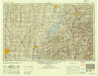
~ Tulsa OK topo map, 1:250000 scale, 1 X 2 Degree, Historical, 1954
Tulsa, Oklahoma, USGS topographic map dated 1954.
Includes geographic coordinates (latitude and longitude). This topographic map is suitable for hiking, camping, and exploring, or framing it as a wall map.
Printed on-demand using high resolution imagery, on heavy weight and acid free paper, or alternatively on a variety of synthetic materials.
Topos available on paper, Waterproof, Poly, or Tyvek. Usually shipping rolled, unless combined with other folded maps in one order.
- Product Number: USGS-5638345
- Free digital map download (high-resolution, GeoPDF): Tulsa, Oklahoma (file size: 26 MB)
- Map Size: please refer to the dimensions of the GeoPDF map above
- Weight (paper map): ca. 55 grams
- Map Type: POD USGS Topographic Map
- Map Series: HTMC
- Map Verison: Historical
- Cell ID: 69064
- Scan ID: 116745
- Woodland Tint: Yes
- Aerial Photo Year: 1945
- Datum: Unstated
- Map Projection: Transverse Mercator
- Shaded Relief map: Yes
- Map published by United States Army Corps of Engineers
- Map published by United States Army
- Map Language: English
- Scanner Resolution: 600 dpi
- Map Cell Name: Tulsa
- Grid size: 1 X 2 Degree
- Date on map: 1954
- Map Scale: 1:250000
- Geographical region: Oklahoma, United States
Neighboring Maps:
All neighboring USGS topo maps are available for sale online at a variety of scales.
Spatial coverage:
Topo map Tulsa, Oklahoma, covers the geographical area associated the following places:
- Simcoe - Bull Hollow - Monark Springs - Crag O Lea - Tontitown - Oaks - Edgewater Acres - Rogers - Accident - Flint Creek - Goodman - Pippin (historical) - El Paso (historical) - Brush Creek - Loma Linda - Walnut Grove - Frisco Springs (historical) - Blewford (historical) - Quapaw - Tipton Ford - Rose - Wann (historical) - McElhany - Bethel Heights - Sanders - Tiger - Springtown - Starks - Mohawk - Habberton - Bethpage - Ruckers Grove (historical) - McCullough Ford - Rochelle Riviera - Eastside - Gideon - Dotyville - Beaty - Westview - Enterprise (historical) - Appleby - Flint (historical) - Moodys - Plainview - Splitlog - Elliff - Cartmell (historical) - West Seneca - Todd - Teresita - Avoca - Mount Shira - Sonora - Stark City - Broken Arrow - Murphy - Sunrise - Ogeechee - Kelso - June - Spring Valley - Alsuma - Fredville - North Miami - Sunsweet - Ritchey - Chloeta - Oak Grove - Cocklebur Flat - Arnett - Wylie - Watts - Oologah - Sperry - White Rock - Wentworth - Oseuma - Ionia - Dawes - Blackjack Corner - Fairmount - Hornet - Potter (historical) - Cove - Wheeler - Fayette Junction - Bernice - Hiwasse - Coodys Bluff - Spring Creek - Vinita - Viney Grove - Fayetteville - West Siloam Springs - Caverna - Creech - Cornatzar - Elkins - Picher (historical) - Pedro
- Map Area ID: AREA3736-96-94
- Northwest corner Lat/Long code: USGSNW37-96
- Northeast corner Lat/Long code: USGSNE37-94
- Southwest corner Lat/Long code: USGSSW36-96
- Southeast corner Lat/Long code: USGSSE36-94
- Northern map edge Latitude: 37
- Southern map edge Latitude: 36
- Western map edge Longitude: -96
- Eastern map edge Longitude: -94


