
~ Yellow Dog Peak CA topo map, 1:24000 scale, 7.5 X 7.5 Minute, Historical, 2012
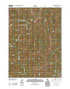
Yellow Dog Peak, California, USGS topographic map dated 2012.
Includes geographic coordinates (latitude and longitude). This topographic map is suitable for hiking, camping, and exploring, or framing it as a wall map.
Printed on-demand using high resolution imagery, on heavy weight and acid free paper, or alternatively on a variety of synthetic materials.
Topos available on paper, Waterproof, Poly, or Tyvek. Usually shipping rolled, unless combined with other folded maps in one order.
- Product Number: USGS-5629865
- Free digital map download (high-resolution, GeoPDF): Yellow Dog Peak, California (file size: 23 MB)
- Map Size: please refer to the dimensions of the GeoPDF map above
- Weight (paper map): ca. 55 grams
- Map Type: POD USGS Topographic Map
- Map Series: US Topo
- Map Verison: Historical
- Cell ID: 50068
- Datum: North American Datum of 1983
- Map Projection: Transverse Mercator
- Map Cell Name: Yellow Dog Peak
- Grid size: 7.5 X 7.5 Minute
- Date on map: 2012
- Map Scale: 1:24000
- Geographical region: California, United States
Neighboring Maps:
All neighboring USGS topo maps are available for sale online at a variety of scales.
Spatial coverage:
Topo map Yellow Dog Peak, California, covers the geographical area associated the following places:
- Abbott Ranch - Right Hand Fork North Fork Salmon River - Wilson Cabin - Deadman Gulch - Wild Gulch - Harry Hall Gulch - Slide Creek - Shotgun Gulch - Little Twin Creek - Timothy Gulch - Deer Pen Creek - Bear Wallow Peak - Atkins Creek - Razor Ridge - Pointers Gulch - Herr Creek - Shelly Gulch - Shelly Meadows - Cabin Gulch - Bug Lake - Babs Lake - The Cedars - Yellow Dog Peak - Flower Gulch - Middle Gulch - J Joe Curve - Bug Gulch - Shelly Lake - Big Creek - Big Twin Creek - Bear Wallow Gulch
- Map Area ID: AREA41.541.375-123.125-123
- Northwest corner Lat/Long code: USGSNW41.5-123.125
- Northeast corner Lat/Long code: USGSNE41.5-123
- Southwest corner Lat/Long code: USGSSW41.375-123.125
- Southeast corner Lat/Long code: USGSSE41.375-123
- Northern map edge Latitude: 41.5
- Southern map edge Latitude: 41.375
- Western map edge Longitude: -123.125
- Eastern map edge Longitude: -123


