
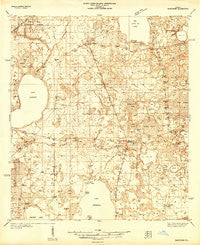
~ Hawthorn FL topo map, 1:48000 scale, 15 X 15 Minute, Historical, 1938
Hawthorn, Florida, USGS topographic map dated 1938.
Includes geographic coordinates (latitude and longitude). This topographic map is suitable for hiking, camping, and exploring, or framing it as a wall map.
Printed on-demand using high resolution imagery, on heavy weight and acid free paper, or alternatively on a variety of synthetic materials.
Topos available on paper, Waterproof, Poly, or Tyvek. Usually shipping rolled, unless combined with other folded maps in one order.
- Product Number: USGS-5621088
- Free digital map download (high-resolution, GeoPDF): Hawthorn, Florida (file size: 11 MB)
- Map Size: please refer to the dimensions of the GeoPDF map above
- Weight (paper map): ca. 55 grams
- Map Type: POD USGS Topographic Map
- Map Series: HTMC
- Map Verison: Historical
- Cell ID: 55177
- Scan ID: 346585
- Survey Year: 1938
- Datum: NAD27
- Map Projection: Polyconic
- Advance: Yes
- Keywords: Nonstandard Press Run
- Map Language: English
- Scanner Resolution: 600 dpi
- Map Cell Name: Hawthorn
- Grid size: 15 X 15 Minute
- Date on map: 1938
- Map Scale: 1:48000
- Geographical region: Florida, United States
Neighboring Maps:
All neighboring USGS topo maps are available for sale online at a variety of scales.
Spatial coverage:
Topo map Hawthorn, Florida, covers the geographical area associated the following places:
- Rex - Micanopy Junction - Copeland Settlement - McMeekin - Beckhamtown - Campville - Rochelle - Lochloosa - Melrose - Newnans Lake Homesites - Windsor - Phifer - Orange Heights - Hawthorne - Grove Park - Earleton - Whispering Pines Commmunity Mobile Home Park
- Map Area ID: AREA29.7529.5-82.25-82
- Northwest corner Lat/Long code: USGSNW29.75-82.25
- Northeast corner Lat/Long code: USGSNE29.75-82
- Southwest corner Lat/Long code: USGSSW29.5-82.25
- Southeast corner Lat/Long code: USGSSE29.5-82
- Northern map edge Latitude: 29.75
- Southern map edge Latitude: 29.5
- Western map edge Longitude: -82.25
- Eastern map edge Longitude: -82


