
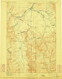
~ Three Forks MT topo map, 1:250000 scale, 1 X 1 Degree, Historical, 1895, updated 1910
Three Forks, Montana, USGS topographic map dated 1895.
Includes geographic coordinates (latitude and longitude). This topographic map is suitable for hiking, camping, and exploring, or framing it as a wall map.
Printed on-demand using high resolution imagery, on heavy weight and acid free paper, or alternatively on a variety of synthetic materials.
Topos available on paper, Waterproof, Poly, or Tyvek. Usually shipping rolled, unless combined with other folded maps in one order.
- Product Number: USGS-5618634
- Free digital map download (high-resolution, GeoPDF): Three Forks, Montana (file size: 8 MB)
- Map Size: please refer to the dimensions of the GeoPDF map above
- Weight (paper map): ca. 55 grams
- Map Type: POD USGS Topographic Map
- Map Series: HTMC
- Map Verison: Historical
- Cell ID: 322317
- Scan ID: 268810
- Imprint Year: 1910
- Survey Year: 1886
- Datum: Unstated
- Map Projection: Unstated
- Map published by United States Geological Survey
- Map Language: English
- Scanner Resolution: 600 dpi
- Map Cell Name: Bozeman W
- Grid size: 1 X 1 Degree
- Date on map: 1895
- Map Scale: 1:250000
- Geographical region: Montana, United States
Neighboring Maps:
All neighboring USGS topo maps are available for sale online at a variety of scales.
Spatial coverage:
Topo map Three Forks, Montana, covers the geographical area associated the following places:
- Greenwood - Nelsons Crossing (historical) - Riverside Trailer Court - Dogtown (historical) - Buell - Country Court - Four Corners - Belgrade Junction - Eldridge (historical) - Haley Subdivision Trailer Court - Sterling - Trident - Woodward Place - Holland - Gallatin (historical) - Beacon Point - Copper City - Lay Settlement (historical) - George Norman Trailer Court - Ennis - Star Mobile Home Park - Adobe (historical) - Powers - Voegeles Trailer Court - Story - Potts Trailer Court - Jeffers - Northeast Annexation Trailer Court - Junction - Forest Park Mobile Home and RV Park - Kerns - Busch - Lower Madison (historical) - Three Forks - Accola - Camona - Abe (historical) - Reese Creek (historical) - Covered Wagon Mobile Home Park - Reed Trailer Court - Gilroy - Big Sky Mountain Village - Carpenter - Summit Valley - Beals - Ponderosa Trailer Court - Wisner Crossing - Jefferson (historical) - Friendly Trailer Court - Alpine Trailer Court - Harrison - Anceney - Big Sky Meadow Village - King Arthur Park - Blackwood - Tee Pee Trailer Court - Edilou - Bridger View Trailer Court - Big Sky - Sappington - West Gallatin - Churchill - Manhattan - Atkins - Stringtown (historical) - Matthews - Springhill - Westlake - Eustis - Walker (historical) - Eldridge Trailer Court - Lux - Virginia City - Jefferson Island - Belgrade Trailer Court - Eau Clair (historical) - Sheds (historical) - Catron - Logan - Cowboys Heaven - Vincent - Pine Grove Trailer Court - Shaws - Menard - Thomasville (historical) - Cardwell - Celander Trailer Court - Bozeman - White - Belgrade - Willow Creek - Murphys Trailer Court - Springhill Park - Norris - Bueno Vista Acres Trailer Court - Middle Creek (historical) - Hidden Valley Mobile Estates - Balmont - Nelsons Trailer Court - Monforton (historical)
- Map Area ID: AREA4645-112-111
- Northwest corner Lat/Long code: USGSNW46-112
- Northeast corner Lat/Long code: USGSNE46-111
- Southwest corner Lat/Long code: USGSSW45-112
- Southeast corner Lat/Long code: USGSSE45-111
- Northern map edge Latitude: 46
- Southern map edge Latitude: 45
- Western map edge Longitude: -112
- Eastern map edge Longitude: -111


