
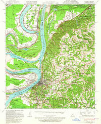
~ Natchez MS topo map, 1:62500 scale, 15 X 15 Minute, Historical, 1939, updated 1965
Natchez, Mississippi, USGS topographic map dated 1939.
Includes geographic coordinates (latitude and longitude). This topographic map is suitable for hiking, camping, and exploring, or framing it as a wall map.
Printed on-demand using high resolution imagery, on heavy weight and acid free paper, or alternatively on a variety of synthetic materials.
Topos available on paper, Waterproof, Poly, or Tyvek. Usually shipping rolled, unless combined with other folded maps in one order.
- Product Number: USGS-5598602
- Free digital map download (high-resolution, GeoPDF): Natchez, Mississippi (file size: 9 MB)
- Map Size: please refer to the dimensions of the GeoPDF map above
- Weight (paper map): ca. 55 grams
- Map Type: POD USGS Topographic Map
- Map Series: HTMC
- Map Verison: Historical
- Cell ID: 58282
- Scan ID: 337001
- Imprint Year: 1965
- Woodland Tint: Yes
- Edit Year: 1939
- Datum: NAD27
- Map Projection: Polyconic
- Map published by United States Geological Survey
- Map published by United States Army Corps of Engineers
- Map published by United States Department of War
- Map Language: English
- Scanner Resolution: 600 dpi
- Map Cell Name: Natchez
- Grid size: 15 X 15 Minute
- Date on map: 1939
- Map Scale: 1:62500
- Geographical region: Mississippi, United States
Neighboring Maps:
All neighboring USGS topo maps are available for sale online at a variety of scales.
Spatial coverage:
Topo map Natchez, Mississippi, covers the geographical area associated the following places:
- Washington - Vidalia - Natchez Under the Hill (historical) - Hawthorne - Selma - Bullitt Bayou - Linwood - Minorca - Anna - White Hall (historical) - Cool Coosa - Spokane - Canebrake - Natchez - Gibson Landing - Scotland (historical) - Johnsville - Saint Catherine - Carthage - Pine Ridge - Taconey - Morgantown - Foster - Mileston Forks - Argent
- Map Area ID: AREA31.7531.5-91.5-91.25
- Northwest corner Lat/Long code: USGSNW31.75-91.5
- Northeast corner Lat/Long code: USGSNE31.75-91.25
- Southwest corner Lat/Long code: USGSSW31.5-91.5
- Southeast corner Lat/Long code: USGSSE31.5-91.25
- Northern map edge Latitude: 31.75
- Southern map edge Latitude: 31.5
- Western map edge Longitude: -91.5
- Eastern map edge Longitude: -91.25


