
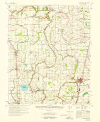
~ Mound Bayou MS topo map, 1:62500 scale, 15 X 15 Minute, Historical, 1968, updated 1968
Mound Bayou, Mississippi, USGS topographic map dated 1968.
Includes geographic coordinates (latitude and longitude). This topographic map is suitable for hiking, camping, and exploring, or framing it as a wall map.
Printed on-demand using high resolution imagery, on heavy weight and acid free paper, or alternatively on a variety of synthetic materials.
Topos available on paper, Waterproof, Poly, or Tyvek. Usually shipping rolled, unless combined with other folded maps in one order.
- Product Number: USGS-5598598
- Free digital map download (high-resolution, GeoPDF): Mound Bayou, Mississippi (file size: 8 MB)
- Map Size: please refer to the dimensions of the GeoPDF map above
- Weight (paper map): ca. 55 grams
- Map Type: POD USGS Topographic Map
- Map Series: HTMC
- Map Verison: Historical
- Cell ID: 57924
- Scan ID: 336998
- Imprint Year: 1968
- Woodland Tint: Yes
- Aerial Photo Year: 1964
- Field Check Year: 1968
- Survey Year: 1966
- Datum: NAD27
- Map Projection: Polyconic
- Map published by United States Army Corps of Engineers
- Map Language: English
- Scanner Resolution: 600 dpi
- Map Cell Name: Mound Bayou
- Grid size: 15 X 15 Minute
- Date on map: 1968
- Map Scale: 1:62500
- Geographical region: Mississippi, United States
Neighboring Maps:
All neighboring USGS topo maps are available for sale online at a variety of scales.
Spatial coverage:
Topo map Mound Bayou, Mississippi, covers the geographical area associated the following places:
- Renova - Dwiggins - Galen (historical) - Jaquith - Ballaston - Merigold - Baltzer - Drew - Powell Bayou - Zumbro - Mound Bayou - Fitzhugh - Promised Land (historical) - Sandy Bayou - Whitney - Lombardy
- Map Area ID: AREA3433.75-90.75-90.5
- Northwest corner Lat/Long code: USGSNW34-90.75
- Northeast corner Lat/Long code: USGSNE34-90.5
- Southwest corner Lat/Long code: USGSSW33.75-90.75
- Southeast corner Lat/Long code: USGSSE33.75-90.5
- Northern map edge Latitude: 34
- Southern map edge Latitude: 33.75
- Western map edge Longitude: -90.75
- Eastern map edge Longitude: -90.5


