
~ Kosciusko MS topo map, 1:62500 scale, 15 X 15 Minute, Historical, 1966, updated 1967
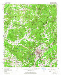
Kosciusko, Mississippi, USGS topographic map dated 1966.
Includes geographic coordinates (latitude and longitude). This topographic map is suitable for hiking, camping, and exploring, or framing it as a wall map.
Printed on-demand using high resolution imagery, on heavy weight and acid free paper, or alternatively on a variety of synthetic materials.
Topos available on paper, Waterproof, Poly, or Tyvek. Usually shipping rolled, unless combined with other folded maps in one order.
- Product Number: USGS-5598506
- Free digital map download (high-resolution, GeoPDF): Kosciusko, Mississippi (file size: 11 MB)
- Map Size: please refer to the dimensions of the GeoPDF map above
- Weight (paper map): ca. 55 grams
- Map Type: POD USGS Topographic Map
- Map Series: HTMC
- Map Verison: Historical
- Cell ID: 56293
- Scan ID: 336948
- Imprint Year: 1967
- Woodland Tint: Yes
- Field Check Year: 1966
- Datum: NAD27
- Map Projection: Polyconic
- Map published by United States Geological Survey
- Map Language: English
- Scanner Resolution: 600 dpi
- Map Cell Name: Kosciusko
- Grid size: 15 X 15 Minute
- Date on map: 1966
- Map Scale: 1:62500
- Geographical region: Mississippi, United States
Neighboring Maps:
All neighboring USGS topo maps are available for sale online at a variety of scales.
Spatial coverage:
Topo map Kosciusko, Mississippi, covers the geographical area associated the following places:
- Unity (historical) - Sand Hill (historical) - North Union (historical) - Thweatt (historical) - Carmack - Munson (historical) - Kosciusko - Rocky Point - McAdams - Plantation - Hurricane - Burkettsville (historical) - Shady Grove - Mount Herman - Pilgrims Rest (historical) - Williamsville - Pleasant Ridge (historical) - Dodds - Oak Ridge (historical) - Langley (historical) - Marvins Chapel - Earlyville - Aponaug (historical) - Pierces Chapel - Hesterville - Center Point (historical) - Auris (historical) - Forrest (historical) - Springdale - Macedonia (historical) - Possumneck - Chita (historical) - Bluff Springs (historical)
- Map Area ID: AREA33.2533-89.75-89.5
- Northwest corner Lat/Long code: USGSNW33.25-89.75
- Northeast corner Lat/Long code: USGSNE33.25-89.5
- Southwest corner Lat/Long code: USGSSW33-89.75
- Southeast corner Lat/Long code: USGSSE33-89.5
- Northern map edge Latitude: 33.25
- Southern map edge Latitude: 33
- Western map edge Longitude: -89.75
- Eastern map edge Longitude: -89.5


