
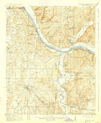
~ Iuka MS topo map, 1:62500 scale, 15 X 15 Minute, Historical, 1914, updated 1927
Iuka, Mississippi, USGS topographic map dated 1914.
Includes geographic coordinates (latitude and longitude). This topographic map is suitable for hiking, camping, and exploring, or framing it as a wall map.
Printed on-demand using high resolution imagery, on heavy weight and acid free paper, or alternatively on a variety of synthetic materials.
Topos available on paper, Waterproof, Poly, or Tyvek. Usually shipping rolled, unless combined with other folded maps in one order.
- Product Number: USGS-5598486
- Free digital map download (high-resolution, GeoPDF): Iuka, Mississippi (file size: 10 MB)
- Map Size: please refer to the dimensions of the GeoPDF map above
- Weight (paper map): ca. 55 grams
- Map Type: POD USGS Topographic Map
- Map Series: HTMC
- Map Verison: Historical
- Cell ID: 55813
- Scan ID: 336938
- Imprint Year: 1927
- Survey Year: 1911
- Datum: NAD
- Map Projection: Polyconic
- Map published by United States Geological Survey
- Map Language: English
- Scanner Resolution: 600 dpi
- Map Cell Name: Iuka
- Grid size: 15 X 15 Minute
- Date on map: 1914
- Map Scale: 1:62500
- Geographical region: Mississippi, United States
Neighboring Maps:
All neighboring USGS topo maps are available for sale online at a variety of scales.
Spatial coverage:
Topo map Iuka, Mississippi, covers the geographical area associated the following places:
- Bacon Springs - Margerum - Crows Camp (historical) - Shaw (historical) - Blythe Crossing - Ingleton (historical) - Walker (historical) - Cooks Landing - Mathews (historical) - Chickasaw (historical) - Pinedale - Lime Kiln - Haddock (historical) - Chisca - Iuka - Buzzard Roost - Riverton - Eastport - Oldham - Mount Olive (historical) - Caryton (historical) - Waterloo - High Point - Short
- Map Area ID: AREA3534.75-88.25-88
- Northwest corner Lat/Long code: USGSNW35-88.25
- Northeast corner Lat/Long code: USGSNE35-88
- Southwest corner Lat/Long code: USGSSW34.75-88.25
- Southeast corner Lat/Long code: USGSSE34.75-88
- Northern map edge Latitude: 35
- Southern map edge Latitude: 34.75
- Western map edge Longitude: -88.25
- Eastern map edge Longitude: -88


