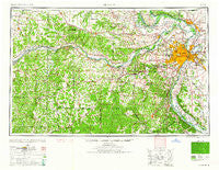
~ St Louis MO topo map, 1:250000 scale, 1 X 2 Degree, Historical, 1962, updated 1962
St Louis, Missouri, USGS topographic map dated 1962.
Includes geographic coordinates (latitude and longitude). This topographic map is suitable for hiking, camping, and exploring, or framing it as a wall map.
Printed on-demand using high resolution imagery, on heavy weight and acid free paper, or alternatively on a variety of synthetic materials.
Topos available on paper, Waterproof, Poly, or Tyvek. Usually shipping rolled, unless combined with other folded maps in one order.
- Product Number: USGS-5575940
- Free digital map download (high-resolution, GeoPDF): St Louis, Missouri (file size: 22 MB)
- Map Size: please refer to the dimensions of the GeoPDF map above
- Weight (paper map): ca. 55 grams
- Map Type: POD USGS Topographic Map
- Map Series: HTMC
- Map Verison: Historical
- Cell ID: 69004
- Scan ID: 325627
- Imprint Year: 1962
- Woodland Tint: Yes
- Aerial Photo Year: 1945
- Datum: Unstated
- Map Projection: Transverse Mercator
- Map published by United States Army Corps of Engineers
- Map published by United States Army
- Map Language: English
- Scanner Resolution: 600 dpi
- Map Cell Name: Saint Louis
- Grid size: 1 X 2 Degree
- Date on map: 1962
- Map Scale: 1:250000
- Geographical region: Missouri, United States
Neighboring Maps:
All neighboring USGS topo maps are available for sale online at a variety of scales.
Spatial coverage:
Topo map St Louis, Missouri, covers the geographical area associated the following places:
- Musicks Ferry - Ranken - Vandeventer - Granite City - Iron Center - Mechanicsville - Fenton - Covenant Blu-Grand Center - Whitecorn - Peabody Darst Webbe - Dorsey - Liberty - Lockhaven - Canaan - Woodhine Heights - Clarkson Valley - East Saint Louis - Herculaneum - Truesdale - Monroe City - Woodstock - Rosewood Heights - Woodville (historical) - Vulcan - Freeburg - Valley Park - Roachtown - Washington Park - Halifax - Danley - Saint Paul - Jeff Vander Lou - Bridgeton Terrace - Tyson - Valles Mines - Cave Hill - Arthur Spring Ford - Alton - Union Hill - Crook - Merrimac - Gilmore - Golden Eagle - Augusta - French Village (historical) - Black Walnut - Marais Croche - Fernridge - Stevens - Brussels - Shrewsbury - Ladue - Forest Park Southeast - Krakow - Mount Freedom - The Diamonds - Firma - Hord (historical) - Fern Glen - Dutchtown - Glen Echo Park - Cote Sans Dessein (historical) - Centreville - Cannon Mines - Montgomery City - Westview - Uplands Park - Gratiot - La Barque Creek - Roxana - North Riverfront - West Alton - Lakeview - Mark Twain - Thomure - Robidoux - Lafayette Square - Lemay - Oldenburg - Oakville - Centaur - Feuersville (historical) - Cedar Hill - Barretts - Timber Trace - Fourche a Renault (historical) - Brevator - Valley View - South Troy - New Truxton - Hillsboro - Egbert - McKittrick - Hazelwood - Prospect Hill - Bernheimer - Castlewood - Beverly Hills - Penrose - Midtown
- Map Area ID: AREA3938-92-90
- Northwest corner Lat/Long code: USGSNW39-92
- Northeast corner Lat/Long code: USGSNE39-90
- Southwest corner Lat/Long code: USGSSW38-92
- Southeast corner Lat/Long code: USGSSE38-90
- Northern map edge Latitude: 39
- Southern map edge Latitude: 38
- Western map edge Longitude: -92
- Eastern map edge Longitude: -90

