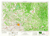
~ Springfield MO topo map, 1:250000 scale, 1 X 2 Degree, Historical, 1954, updated 1967
Springfield, Missouri, USGS topographic map dated 1954.
Includes geographic coordinates (latitude and longitude). This topographic map is suitable for hiking, camping, and exploring, or framing it as a wall map.
Printed on-demand using high resolution imagery, on heavy weight and acid free paper, or alternatively on a variety of synthetic materials.
Topos available on paper, Waterproof, Poly, or Tyvek. Usually shipping rolled, unless combined with other folded maps in one order.
- Product Number: USGS-5575930
- Free digital map download (high-resolution, GeoPDF): Springfield, Missouri (file size: 22 MB)
- Map Size: please refer to the dimensions of the GeoPDF map above
- Weight (paper map): ca. 55 grams
- Map Type: POD USGS Topographic Map
- Map Series: HTMC
- Map Verison: Historical
- Cell ID: 69036
- Scan ID: 325622
- Imprint Year: 1967
- Woodland Tint: Yes
- Aerial Photo Year: 1954
- Edit Year: 1966
- Datum: Unstated
- Map Projection: Transverse Mercator
- Map published by United States Army Corps of Engineers
- Map published by United States Army
- Map Language: English
- Scanner Resolution: 600 dpi
- Map Cell Name: Springfield
- Grid size: 1 X 2 Degree
- Date on map: 1954
- Map Scale: 1:250000
- Geographical region: Missouri, United States
Neighboring Maps:
All neighboring USGS topo maps are available for sale online at a variety of scales.
Spatial coverage:
Topo map Springfield, Missouri, covers the geographical area associated the following places:
- Flemington - Nickelville - Sentinel - Abadyl - Rondo - Niangua Junction - Wheatland - Boyer - Westfield - Garnsey - Palace - Grays Point - Paris Springs - Big Piney - Olive - Dixon - Cedar Bluff - Duncan - Pearl - Graff - Cabool - Pembina - Ozark Springs - Emmett (historical) - Simmons - Mountain Grove - Battlefield - Wheelers Mill - Cedarville - Oak Grove Heights - Henderson - Snadon Ford - Hardyville - Sleeper - Brownfield - Saint Annie - Bolivar - Opal - Old Success - Bracken - Burney Ford - Pumpkin Center - Heatonville - Rail - Glen Town - Billings - Rookins - Midway - Roby - Ebenezer - Spencer - Haseltine - Hillhouse Addition - Foose - Eldridge - Jerktail - Brookline - Alsup - Umber View Heights - Meinert - Johns Mills (historical) - Willowville - Claud - Pilgrim - Glaize (historical) - Edsall (historical) - Sims Point - Sweet Hollow Ford (historical) - Mazzaville Resort - Earnestville - Ozark - Marionville - Buckley (historical) - Carsons Corner - Roubidoux - Prior - Helm - Filer - Miller Ford (historical) - Decaturville - Bona - Boyd - Long Lane - Bado - McCracken - Zenda - Ivy - Plum Valley - Morrisville - Glidewell - Crown - Halfway - Landrum - Aldrich - Olinger - Grays Valley - Cross Way - Vista - Smittle - Avalon Park
- Map Area ID: AREA3837-94-92
- Northwest corner Lat/Long code: USGSNW38-94
- Northeast corner Lat/Long code: USGSNE38-92
- Southwest corner Lat/Long code: USGSSW37-94
- Southeast corner Lat/Long code: USGSSE37-92
- Northern map edge Latitude: 38
- Southern map edge Latitude: 37
- Western map edge Longitude: -94
- Eastern map edge Longitude: -92

