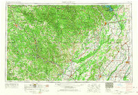
~ Poplar Bluff MO topo map, 1:250000 scale, 1 X 2 Degree, Historical, 1957, updated 1968
Poplar Bluff, Missouri, USGS topographic map dated 1957.
Includes geographic coordinates (latitude and longitude). This topographic map is suitable for hiking, camping, and exploring, or framing it as a wall map.
Printed on-demand using high resolution imagery, on heavy weight and acid free paper, or alternatively on a variety of synthetic materials.
Topos available on paper, Waterproof, Poly, or Tyvek. Usually shipping rolled, unless combined with other folded maps in one order.
- Product Number: USGS-5575908
- Free digital map download (high-resolution, GeoPDF): Poplar Bluff, Missouri (file size: 21 MB)
- Map Size: please refer to the dimensions of the GeoPDF map above
- Weight (paper map): ca. 55 grams
- Map Type: POD USGS Topographic Map
- Map Series: HTMC
- Map Verison: Historical
- Cell ID: 74976
- Scan ID: 325611
- Imprint Year: 1968
- Woodland Tint: Yes
- Edit Year: 1967
- Field Check Year: 1957
- Datum: Unstated
- Map Projection: Transverse Mercator
- Map published by United States Army Corps of Engineers
- Map published by United States Army
- Map Language: English
- Scanner Resolution: 600 dpi
- Map Cell Name: Poplar Bluff
- Grid size: 1 X 2 Degree
- Date on map: 1957
- Map Scale: 1:250000
- Geographical region: Missouri, United States
Neighboring Maps:
All neighboring USGS topo maps are available for sale online at a variety of scales.
Spatial coverage:
Topo map Poplar Bluff, Missouri, covers the geographical area associated the following places:
- Sloan - Evorge - Jay - Whitlow - Franklin - Birdell - West Plains - Elm Store - Torch - Armstrong - Reed (historical) - Cull - Rossville - Williamsville - Broseley - Camp - New Liberty - Fontaine - Faulknerville - Watervalley (historical) - Keener Cave - Octa - Junland - Cornertown - Fremont - Fritz - Oxford - Oak Grove Heights - Eastwood - Allen Ford - Peach Orchard - Cedar Grove - Cobb - Johnson Mill - Rhyne - Brockwell - Ebenezer - Greer - Hilliard - Portia - Keeners - Heart - Ravenden - Shreve - Peach (historical) - Ipley - Powe - Lone Star - Hanleyville - Cherokee Village - Willow Springs - Brighton - Morning Star - Oxly - Walnut Ridge - Evening Shade - Hillside (historical) - Green Oaks - Black Jack - Pratt - Pocohontas Crossing - Glenn - Homestead (historical) - Murta - Kingsville (historical) - Flatwoods - Rombauer - Parks - Wheeling - Lesterville - Platanus (historical) - Frankville - Holcomb - Calamine - Hardy - Knobel - Heelstring - Hooker - Kelly Town - Maynard - Budapest - Lebo - Imboden - Rover - Low Wassie - Draft (historical) - Whiskerville - O'Kean - Hornersville Junction - Fryatt - Scobeville - Hickoria - Ferrys (historical) - Green High - Wirth - Twin Oaks - Poplar Bluff - Hunter - Woodland Hills - Caneer
- Map Area ID: AREA3736-92-90
- Northwest corner Lat/Long code: USGSNW37-92
- Northeast corner Lat/Long code: USGSNE37-90
- Southwest corner Lat/Long code: USGSSW36-92
- Southeast corner Lat/Long code: USGSSE36-90
- Northern map edge Latitude: 37
- Southern map edge Latitude: 36
- Western map edge Longitude: -92
- Eastern map edge Longitude: -90

