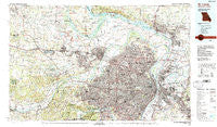
~ St Louis MO topo map, 1:100000 scale, 30 X 60 Minute, Historical, 1985, updated 1988
St Louis, Missouri, USGS topographic map dated 1985.
Includes geographic coordinates (latitude and longitude). This topographic map is suitable for hiking, camping, and exploring, or framing it as a wall map.
Printed on-demand using high resolution imagery, on heavy weight and acid free paper, or alternatively on a variety of synthetic materials.
Topos available on paper, Waterproof, Poly, or Tyvek. Usually shipping rolled, unless combined with other folded maps in one order.
- Product Number: USGS-5575506
- Free digital map download (high-resolution, GeoPDF): St Louis, Missouri (file size: 36 MB)
- Map Size: please refer to the dimensions of the GeoPDF map above
- Weight (paper map): ca. 55 grams
- Map Type: POD USGS Topographic Map
- Map Series: HTMC
- Map Verison: Historical
- Cell ID: 68283
- Scan ID: 325402
- Imprint Year: 1988
- Woodland Tint: Yes
- Aerial Photo Year: 1983
- Edit Year: 1985
- Datum: NAD27
- Map Projection: Universal Transverse Mercator
- Map published by United States Geological Survey
- Map Language: English
- Scanner Resolution: 600 dpi
- Map Cell Name: Saint Louis
- Grid size: 30 X 60 Minute
- Date on map: 1985
- Map Scale: 1:100000
- Geographical region: Missouri, United States
Neighboring Maps:
All neighboring USGS topo maps are available for sale online at a variety of scales.
Spatial coverage:
Topo map St Louis, Missouri, covers the geographical area associated the following places:
- Augusta - Sterling Place - Glencoe - Washington Park - Ellendale - McKinley Heights - Elm Point - Marlborough - Blase - Bellerive Acres - Keyes Summit - Moscow Mills - Hilltop - Jefferson Barracks - Crest Hill - Stevens - Wilkie - Saint Johns - Breckenridge Hills - Orchard Farm - Jacobs - Skinker-De Baliviere - Lake - Cabanne Place - Sauget - Highland Estates - Arbor Terrace - Riehl - Centreville - South Shore - Ranken - Glen Echo Park - Bel-Ridge - Wildwood - Spanish Lake - Tyson - Kendall Hill - La Charbonniere (historical) - Gratiot - Dupo - Cherokee Park - Piasa Hills - Midtown - Hamburg - Centerville - Peine Woods - Moellenbrocks - Foristell - East Carondelet - All Saints Village - Summit - Huntsdale - Cedar Bluff - Tower Grove East - Mackenzie - Beckett (historical) - Near North Riverfront - Academy - Enon - Chautauqua - Lakeview - Golden Gardens - Belmont Village - Skinker - Crescent - Pond - Hathaway Meadows - Clifton Terrace - Roxana - Kic-ka-poo Village (historical) - Castle Point - Black Jack - Prospect Hill - Crystal Creek - Alton - Covenant Blu-Grand Center - Grantwood Village - Falling Spring - Saint Thomas - Ladue - Cap au Gris - Sunset Hills - Wanda - Frontenac - Carr Square - Kingsway West - French Village - North Pointe - Riverview - Lafayette Square - Brooklyn - Boles - Clayton - South Troy - Fairmont City - Hyde Park - Hanley Hills - Maryland Place - Bellefontaine - Quatoga Bluff
- Map Area ID: AREA3938.5-91-90
- Northwest corner Lat/Long code: USGSNW39-91
- Northeast corner Lat/Long code: USGSNE39-90
- Southwest corner Lat/Long code: USGSSW38.5-91
- Southeast corner Lat/Long code: USGSSE38.5-90
- Northern map edge Latitude: 39
- Southern map edge Latitude: 38.5
- Western map edge Longitude: -91
- Eastern map edge Longitude: -90

