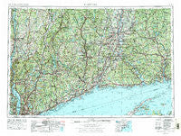
~ Hartford CT topo map, 1:250000 scale, 1 X 2 Degree, Historical, 1962, updated 1976
Hartford, Connecticut, USGS topographic map dated 1962.
Includes geographic coordinates (latitude and longitude). This topographic map is suitable for hiking, camping, and exploring, or framing it as a wall map.
Printed on-demand using high resolution imagery, on heavy weight and acid free paper, or alternatively on a variety of synthetic materials.
Topos available on paper, Waterproof, Poly, or Tyvek. Usually shipping rolled, unless combined with other folded maps in one order.
- Product Number: USGS-5566648
- Free digital map download (high-resolution, GeoPDF): Hartford, Connecticut (file size: 28 MB)
- Map Size: please refer to the dimensions of the GeoPDF map above
- Weight (paper map): ca. 55 grams
- Map Type: POD USGS Topographic Map
- Map Series: HTMC
- Map Verison: Historical
- Cell ID: 72228
- Scan ID: 331224
- Imprint Year: 1976
- Woodland Tint: Yes
- Aerial Photo Year: 1974
- Edit Year: 1975
- Field Check Year: 1962
- Datum: Unstated
- Map Projection: Transverse Mercator
- Map published by United States Geological Survey
- Map Language: English
- Scanner Resolution: 600 dpi
- Map Cell Name: Hartford
- Grid size: 1 X 2 Degree
- Date on map: 1962
- Map Scale: 1:250000
- Geographical region: Connecticut, United States
Neighboring Maps:
All neighboring USGS topo maps are available for sale online at a variety of scales.
Spatial coverage:
Topo map Hartford, Connecticut, covers the geographical area associated the following places:
- Clark Heights - Oscawana - Barkhampsted Center - Erickson Corner - West Norwood - Cedar Cliff - Grover Hill - Weatogue - West Patterson - Stanwich - Scarsdale - North Branford - Birchwood - Lamson Corner - Strathmore Woods - Billings - Goodrich Heights - Crowleys Corner - East Port Chester (historical) - Redding Ridge - East Park Mobile Home Park - The Creek Beach - Emmons City (historical) - Greenfield Hill - Plattsville - Goldens Bridge - Centerville - Highland Falls - Columbia - Achenbach - Wolcott - Talcottville - Barber Corner (historical) - Armonk - Middle Haddam - New Guinea (historical) - Saugatuck - Mill Hill - Chesterfield - Gilead - Quakertown - Baltic - Valley Cottage - Waterville - Spring Village - Macedonia - Gales Ferry - Leffingwell (historical) - South Nyack - Farmington Station - Kenyonville - New City - Millbrook - North Goshen - Grand View-on-Hudson - Sears Corners - Center Groton - Phoenixville - Fernwood Estates - Pulvers Corners - Milton - Bigelow Corners - Cos Cob - Cranbury - Grappaville - Ridgefield - Edgewood - Milltown - High Ridge - Salem Center - Bains Corner - Millstone - Timothy Heights - Lime Rock - H and H Mobile Home Park - Tyler Lake Heights - Black Point - Podunk - Village Hill - Crowley Corner - Green Manor Village - Hibernia - Croton Heights - Aqua Vista - Hollywyle Park - West Park - Patterson - Allentown - Bretton Heights - Grace Estate - North Westchester - Fort Trumbull - Grassy Hill (historical) - Ivoryton - Litchfield - Oregon - Saybrook Point - Nautilus Park - Foote Corners - Mansfield Center
- Map Area ID: AREA4241-74-72
- Northwest corner Lat/Long code: USGSNW42-74
- Northeast corner Lat/Long code: USGSNE42-72
- Southwest corner Lat/Long code: USGSSW41-74
- Southeast corner Lat/Long code: USGSSE41-72
- Northern map edge Latitude: 42
- Southern map edge Latitude: 41
- Western map edge Longitude: -74
- Eastern map edge Longitude: -72

