
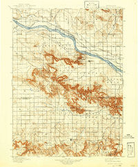
~ Scotts Bluff NE topo map, 1:125000 scale, 30 X 30 Minute, Historical, 1898, updated 1942
Scotts Bluff, Nebraska, USGS topographic map dated 1898.
Includes geographic coordinates (latitude and longitude). This topographic map is suitable for hiking, camping, and exploring, or framing it as a wall map.
Printed on-demand using high resolution imagery, on heavy weight and acid free paper, or alternatively on a variety of synthetic materials.
Topos available on paper, Waterproof, Poly, or Tyvek. Usually shipping rolled, unless combined with other folded maps in one order.
- Product Number: USGS-5563944
- Free digital map download (high-resolution, GeoPDF): Scotts Bluff, Nebraska (file size: 9 MB)
- Map Size: please refer to the dimensions of the GeoPDF map above
- Weight (paper map): ca. 55 grams
- Map Type: POD USGS Topographic Map
- Map Series: HTMC
- Map Verison: Historical
- Cell ID: 66585
- Scan ID: 317863
- Imprint Year: 1942
- Survey Year: 1895
- Datum: Unstated
- Map Projection: Polyconic
- Map published by United States Geological Survey
- Map Language: English
- Scanner Resolution: 600 dpi
- Map Cell Name: Scotts Bluff
- Grid size: 30 X 30 Minute
- Date on map: 1898
- Map Scale: 1:125000
- Geographical region: Nebraska, United States
Neighboring Maps:
All neighboring USGS topo maps are available for sale online at a variety of scales.
Spatial coverage:
Topo map Scotts Bluff, Nebraska, covers the geographical area associated the following places:
- Haig - Melbeta - South Mitchell - Covert - Joyce - Northside Mobile Home Ranch - Doyle - Hillerage - Scottsbluff - James - Hubbard Corner - Jane - Mintle - Sunrise Village Mobile Home Park - Hartman - Mitchell - Gering - Harrys Mobile Home Incorporated - Trout - Minatare - Pelton - Harrisburg - Evergreen Estates Mobile Homes - Caldwell (historical) - Morrill - Heldt - Morrill Mobile Home Estates - Redus - Costin - Sunflower Mobile Home Park - Stegall - Carlson - South Morrill - Terrytown
- Map Area ID: AREA4241.5-104-103.5
- Northwest corner Lat/Long code: USGSNW42-104
- Northeast corner Lat/Long code: USGSNE42-103.5
- Southwest corner Lat/Long code: USGSSW41.5-104
- Southeast corner Lat/Long code: USGSSE41.5-103.5
- Northern map edge Latitude: 42
- Southern map edge Latitude: 41.5
- Western map edge Longitude: -104
- Eastern map edge Longitude: -103.5


