
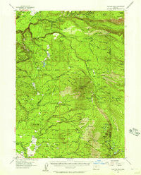
~ Rustler Peak OR topo map, 1:62500 scale, 15 X 15 Minute, Historical, 1955, updated 1961
Rustler Peak, Oregon, USGS topographic map dated 1955.
Includes geographic coordinates (latitude and longitude). This topographic map is suitable for hiking, camping, and exploring, or framing it as a wall map.
Printed on-demand using high resolution imagery, on heavy weight and acid free paper, or alternatively on a variety of synthetic materials.
Topos available on paper, Waterproof, Poly, or Tyvek. Usually shipping rolled, unless combined with other folded maps in one order.
- Product Number: USGS-5545300
- Free digital map download (high-resolution, GeoPDF): Rustler Peak, Oregon (file size: 10 MB)
- Map Size: please refer to the dimensions of the GeoPDF map above
- Weight (paper map): ca. 55 grams
- Map Type: POD USGS Topographic Map
- Map Series: HTMC
- Map Verison: Historical
- Cell ID: 61861
- Scan ID: 282855
- Imprint Year: 1961
- Woodland Tint: Yes
- Aerial Photo Year: 1953
- Field Check Year: 1955
- Datum: NAD27
- Map Projection: Polyconic
- Map published by United States Geological Survey
- Map Language: English
- Scanner Resolution: 600 dpi
- Map Cell Name: Rustler Peak
- Grid size: 15 X 15 Minute
- Date on map: 1955
- Map Scale: 1:62500
- Geographical region: Oregon, United States
Neighboring Maps:
All neighboring USGS topo maps are available for sale online at a variety of scales.
Spatial coverage:
Topo map Rustler Peak, Oregon, covers the geographical area associated the following places:
- Mule Creek - Mudjekeewis Trail - Mudjekeewis Mountain - Fall Creek - Buck Creek - Halifax Creek - Clarks Fork Creek - Dead Dog Gulch - Prospect State Airport - Fireline Creek - Rustler Peak - Kerby Hill - Geppert Creek - Goss Ranch - West Fork Ash Creek - Oak Mountain - Willow Creek - Rancheria Prairie - Snowshoe Forest Camp (historical) - Parsnip Creek - Lodgepole Creek - Zimmerman Burn - Thomson Ranch - Blue Cow Spring - Wickiup Spring - Pioneer Post Office (historical) - Svinth Creek - Timberline Creek - Fire Creek - Carey Lake - Bessie Creek - Wickiup Shelter - Goss Trail - South Fork Trail - Barr Creek Falls - Big Ben Creek - Whitman Creek - Prospect State Park - Blue Goose Spring - Buck Basin Fork - Mill Creek - Snowbrush Gulch - Beaver Dam Creek - Jackass Creek - Fourbit Creek - Ash Creek - Foot Creek - Dailey Dam - Big Butte Springs - Rogue Head Camp - Saddle Campground (historical) - Blue Rock - Otter Spring - Fire Spring - Camp Creek - Medco Pond - South Fork Wallowa Creek - Mill Creek Falls - Salt Fork Fourbit Creek - Phillips Creek - McKee Basin - Snowshoe Butte - Misfit Creek - Hemlock Spring - Titanic Creek - South Fork Dam - South Fork Vine Maple Creek - Twentynine Creek - McKee Lake - Cedar Springs Creek - Middle Fork Parsnip Creek - Upper South Fork Campground (historical) - Pear Lake Camp - Blue Canyon Lake - Wallowa Creek - Stanley Meadows - Prospect Powerhouse - Lemont Post Office (historical) - Carney Lake Camp (historical) - Merle Burn - Lookout Gulch - North Fork Fourbit Creek - South Blue Lake Group - Rancheria Ranch - Blue Canyon Trail - Northern Glades - Camp Four - Fourbit Ford - Doug Ingram Tree - North Fork Clarks Fork Creek - Horseshoe Lake - Rancheria Creek - Parker Creek - Little Billie Creek - Spring Creek - Daniel Spring - Sumpter Creek - Friese Creek - Horseshoe Creek - Conley Spring
- Map Area ID: AREA42.7542.5-122.5-122.25
- Northwest corner Lat/Long code: USGSNW42.75-122.5
- Northeast corner Lat/Long code: USGSNE42.75-122.25
- Southwest corner Lat/Long code: USGSSW42.5-122.5
- Southeast corner Lat/Long code: USGSSE42.5-122.25
- Northern map edge Latitude: 42.75
- Southern map edge Latitude: 42.5
- Western map edge Longitude: -122.5
- Eastern map edge Longitude: -122.25


