
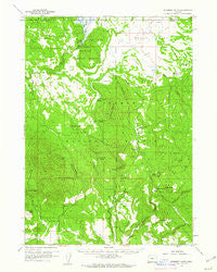
~ Riverbed Butte OR topo map, 1:62500 scale, 15 X 15 Minute, Historical, 1960, updated 1961
Riverbed Butte, Oregon, USGS topographic map dated 1960.
Includes geographic coordinates (latitude and longitude). This topographic map is suitable for hiking, camping, and exploring, or framing it as a wall map.
Printed on-demand using high resolution imagery, on heavy weight and acid free paper, or alternatively on a variety of synthetic materials.
Topos available on paper, Waterproof, Poly, or Tyvek. Usually shipping rolled, unless combined with other folded maps in one order.
- Product Number: USGS-5545280
- Free digital map download (high-resolution, GeoPDF): Riverbed Butte, Oregon (file size: 7 MB)
- Map Size: please refer to the dimensions of the GeoPDF map above
- Weight (paper map): ca. 55 grams
- Map Type: POD USGS Topographic Map
- Map Series: HTMC
- Map Verison: Historical
- Cell ID: 61643
- Scan ID: 282841
- Imprint Year: 1961
- Woodland Tint: Yes
- Aerial Photo Year: 1956
- Field Check Year: 1960
- Datum: NAD27
- Map Projection: Polyconic
- Map published by United States Geological Survey
- Map Language: English
- Scanner Resolution: 600 dpi
- Map Cell Name: Riverbed Butte
- Grid size: 15 X 15 Minute
- Date on map: 1960
- Map Scale: 1:62500
- Geographical region: Oregon, United States
Neighboring Maps:
All neighboring USGS topo maps are available for sale online at a variety of scales.
Spatial coverage:
Topo map Riverbed Butte, Oregon, covers the geographical area associated the following places:
- Piute Rock - Rodeo Spring - Dice Spring - Mill Creek Spring - Ponina Spring - Electric Pond - Marsh Reservoir - Lonesome Pond - Horse Glade - Cold Spring - Rodeo Butte - Merritt Reservoir - Reservoir Creek - Old Pelican Bay Camp (historical) - Sycan Fire Guard Station - Merritt Creek - Rail Glade - Mill Creek - Swamp Spring - Pelland Spring - McCartie Ranch - Small Spring - Sycan Flat - Klipple Lake - Long Creek - Rimrock Point - Griffin Ranch - Camp Six - Dicks Well - Swamp Creek - Powerline Pond - Bob Flat - Huckleberry Draw - Packsaddle Spring - Thicket Spring - Horseglade Spring - Evans Pit Tank - Frying Pan Spring - O'Connors Puddle Reservoir - Obenchain Ranch - Camp Six Guard Station - Black Hills Guard Station - Echo Pit Tank - Riverbed Butte - Bob Creek - Anderson Cabin - Buck Spring - O'Connors Puddle Dam - Cain Creek - Meryl Springs - Watkins Spring - Ace Pond - Preacher Flat - Wild Pond - Foster Field - Black Hills Guard Station Spring - Riverbed Butte Spring - The Basin - Evans Creek - Ponina Creek - Black Hills - Ponina Butte
- Map Area ID: AREA42.7542.5-121.25-121
- Northwest corner Lat/Long code: USGSNW42.75-121.25
- Northeast corner Lat/Long code: USGSNE42.75-121
- Southwest corner Lat/Long code: USGSSW42.5-121.25
- Southeast corner Lat/Long code: USGSSE42.5-121
- Northern map edge Latitude: 42.75
- Southern map edge Latitude: 42.5
- Western map edge Longitude: -121.25
- Eastern map edge Longitude: -121


