
~ Powell Buttes OR topo map, 1:62500 scale, 15 X 15 Minute, Historical, 1962, updated 1963
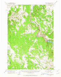
Powell Buttes, Oregon, USGS topographic map dated 1962.
Includes geographic coordinates (latitude and longitude). This topographic map is suitable for hiking, camping, and exploring, or framing it as a wall map.
Printed on-demand using high resolution imagery, on heavy weight and acid free paper, or alternatively on a variety of synthetic materials.
Topos available on paper, Waterproof, Poly, or Tyvek. Usually shipping rolled, unless combined with other folded maps in one order.
- Product Number: USGS-5545228
- Free digital map download (high-resolution, GeoPDF): Powell Buttes, Oregon (file size: 7 MB)
- Map Size: please refer to the dimensions of the GeoPDF map above
- Weight (paper map): ca. 55 grams
- Map Type: POD USGS Topographic Map
- Map Series: HTMC
- Map Verison: Historical
- Cell ID: 61257
- Scan ID: 282807
- Imprint Year: 1963
- Woodland Tint: Yes
- Aerial Photo Year: 1957
- Field Check Year: 1962
- Datum: NAD27
- Map Projection: Polyconic
- Map published by United States Geological Survey
- Map Language: English
- Scanner Resolution: 600 dpi
- Map Cell Name: Powell Buttes
- Grid size: 15 X 15 Minute
- Date on map: 1962
- Map Scale: 1:62500
- Geographical region: Oregon, United States
Neighboring Maps:
All neighboring USGS topo maps are available for sale online at a variety of scales.
Spatial coverage:
Topo map Powell Buttes, Oregon, covers the geographical area associated the following places:
- Goering Ranches Airport - Ponderosa Substation - Dry Creek Reservoirs - Casey Spring - Stearns Butte - Stearns Dam - Powder House Cove - Hat Rock Post Office (historical) - Dry Creek Airpark - Horse Butte - Baldwin Ditch - Dempsey Spring - Bowman Dam - Stearns Ranch - Rooster Comb - Powder House Cove Boat Ramp - Red Cloud Ranch - Bear Creek - Chimney Rock - Perry Creek - Price Spring - Hat Rock - Taylor Butte - Chimney Rock Campground - Devils Canyon - Crook County Fire and Rescue - Juniper Canyon - Hoffman Dam - Dry Creek Number Two Dam - Dry Creek Number Two Reservoir - Three Spring Ranch - Rocky Canyon - Hay Creek Post Office (historical) - Bear Creek Butte - Wells Spring - Powell Buttes - Baldwin Dam - Bear Creek Agate Beds - Statz Spring - Swartz Canyon - Dry Creek - Williamson Creek - Hoffman Ditch - Prineville Reservoir County Boat Ramp - Stearns Ditch
- Map Area ID: AREA44.2544-121-120.75
- Northwest corner Lat/Long code: USGSNW44.25-121
- Northeast corner Lat/Long code: USGSNE44.25-120.75
- Southwest corner Lat/Long code: USGSSW44-121
- Southeast corner Lat/Long code: USGSSE44-120.75
- Northern map edge Latitude: 44.25
- Southern map edge Latitude: 44
- Western map edge Longitude: -121
- Eastern map edge Longitude: -120.75


