
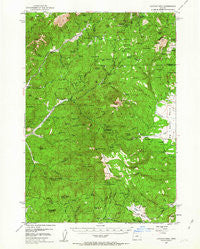
~ Lookout Mtn OR topo map, 1:62500 scale, 15 X 15 Minute, Historical, 1951, updated 1963
Lookout Mtn, Oregon, USGS topographic map dated 1951.
Includes geographic coordinates (latitude and longitude). This topographic map is suitable for hiking, camping, and exploring, or framing it as a wall map.
Printed on-demand using high resolution imagery, on heavy weight and acid free paper, or alternatively on a variety of synthetic materials.
Topos available on paper, Waterproof, Poly, or Tyvek. Usually shipping rolled, unless combined with other folded maps in one order.
- Product Number: USGS-5544994
- Free digital map download (high-resolution, GeoPDF): Lookout Mtn, Oregon (file size: 10 MB)
- Map Size: please refer to the dimensions of the GeoPDF map above
- Weight (paper map): ca. 55 grams
- Map Type: POD USGS Topographic Map
- Map Series: HTMC
- Map Verison: Historical
- Cell ID: 56891
- Scan ID: 282669
- Imprint Year: 1963
- Woodland Tint: Yes
- Aerial Photo Year: 1950
- Field Check Year: 1951
- Datum: NAD27
- Map Projection: Polyconic
- Map published by United States Geological Survey
- Map Language: English
- Scanner Resolution: 600 dpi
- Map Cell Name: Lookout Mountain
- Grid size: 15 X 15 Minute
- Date on map: 1951
- Map Scale: 1:62500
- Geographical region: Oregon, United States
Neighboring Maps:
All neighboring USGS topo maps are available for sale online at a variety of scales.
Spatial coverage:
Topo map Lookout Mtn, Oregon, covers the geographical area associated the following places:
- Koch Butte - Butterfield Spring - Crusher Creek - Cougar Forest Camp - Crystal Creek - Arthur Creek Camp - Crooked Tree Spring - Long Hollow Creek - Sulphur Spring Butte - Whistler Recreation Site - Crystal Springs Organization Camp - Cadle Creek - Cuitan Creek - Boardtree Creek - Marks Creek Lodge - Old Kelly Mill (historical) - Crow Spring - Gerow Spring - Cline Creek - O'Neil Creek - Walton Lake Boat Ramp - Round Mountain - Whistler Spring - Lava Spring - Willow Creek - Lodgepole Creek - Wildcat Creek - Peaslee Creek - Fawn Creek - Shamrock Creek - Ochoco Post Office (historical) - Cup Spring - Downs Spring - Big Spread Spring - Cady Creek - Cougar Rock - Hellbore Spring - Thorn Creek - Grant Meadows - Whitney Creek - Hedgepath Creek - Walton Lake - Wildhorse Spring - McAllister Creek - Spring Creek - North Point - Stewart Spring - Indian Butte - Ochoco Mine - Hon Spring - Slide Mountain - Lunch Spring - View Point - Mount Bachelor Academy - Carroll Glade - East Fork Howard Creek - McAllister Spring - Koch Reservoir - Rush Creek - Hawkins Butte - Nature Creek - Mercury Creek - O'Neil Spring - Spears Meadow - Polie Creek - Judy Spring - Deadman Creek - Pothole Spring - Hamilton Creek - O'Neil Butte - Scissors Spring - Ochoco Mountains - Wickheiser Spring - Lake Spring - Duncan Butte - Kemp Spring - Garden Creek - Amity Mine - Cox Reservoir - Buck Creek - Lost Spring Reservoir - Merritt Creek - Ochoco Spring - Thompson Spring - Marks Lake Dam - Gerow Butte Lookout Tower - Walton Lake Recreation Site - Judy Creek - Walton Lake Campground - Coyle Spring - Ochoco Butte - Simpson Place - Hamilton Spring - Bandit Spring - Biggs Spring - Douthit Creek - Duncan Creek - Mahogany Spring - Buck Creek - Ochoco Recreation Site
- Map Area ID: AREA44.544.25-120.5-120.25
- Northwest corner Lat/Long code: USGSNW44.5-120.5
- Northeast corner Lat/Long code: USGSNE44.5-120.25
- Southwest corner Lat/Long code: USGSSW44.25-120.5
- Southeast corner Lat/Long code: USGSSE44.25-120.25
- Northern map edge Latitude: 44.5
- Southern map edge Latitude: 44.25
- Western map edge Longitude: -120.5
- Eastern map edge Longitude: -120.25


