
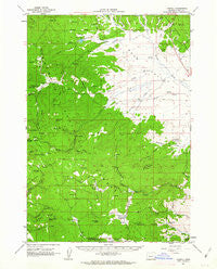
~ Logdell OR topo map, 1:62500 scale, 15 X 15 Minute, Historical, 1961, updated 1963
Logdell, Oregon, USGS topographic map dated 1961.
Includes geographic coordinates (latitude and longitude). This topographic map is suitable for hiking, camping, and exploring, or framing it as a wall map.
Printed on-demand using high resolution imagery, on heavy weight and acid free paper, or alternatively on a variety of synthetic materials.
Topos available on paper, Waterproof, Poly, or Tyvek. Usually shipping rolled, unless combined with other folded maps in one order.
- Product Number: USGS-5544984
- Free digital map download (high-resolution, GeoPDF): Logdell, Oregon (file size: 8 MB)
- Map Size: please refer to the dimensions of the GeoPDF map above
- Weight (paper map): ca. 55 grams
- Map Type: POD USGS Topographic Map
- Map Series: HTMC
- Map Verison: Historical
- Cell ID: 56848
- Scan ID: 282662
- Imprint Year: 1963
- Woodland Tint: Yes
- Aerial Photo Year: 1957
- Field Check Year: 1961
- Datum: NAD27
- Map Projection: Polyconic
- Map published by United States Geological Survey
- Map Language: English
- Scanner Resolution: 600 dpi
- Map Cell Name: Logdell
- Grid size: 15 X 15 Minute
- Date on map: 1961
- Map Scale: 1:62500
- Geographical region: Oregon, United States
Neighboring Maps:
All neighboring USGS topo maps are available for sale online at a variety of scales.
Spatial coverage:
Topo map Logdell, Oregon, covers the geographical area associated the following places:
- Oxbow Butte - Roads End Spring - Klink Reservoir - Swick Creek - Jack Creek - Cold Creek - Paine Creek - Grasshopper Flat - Rail Gulch - South Scotty Creek - Ninety Six Spring - Luce Creek - East Scotty Creek - Pine Spring - Koehler Ranch - Lowe Ranch - Gilbert Ridge - Poison Spring - Randall Spring - Station Spring - Five Hundred Flat - D M Spring - Burntcabin Creek - Ninety-Six Ranch - Van Aspen Creek - S-2 Spring - Lost Creek - Sproul Ranch - Snowshoe Creek - Smith Meadows - Jenkins Creek - Duncanville Post Office (historical) - Geary Creek - Windy Point - Hay Creek - Wymer Creek - Officer Springs - Crooked Creek - Holliday Ranch - Mothers Creek - Elkhorn Cow Camp - Ferris Spring - Laycock Spring - Bear Valley Work Center - Cerny Airport - McArthur Spring - Blanton Post Office (historical) - Lost Cabin - Rail Creek - Logdell Post Office (historical) - Logdell - Homer Post Office (historical) - Damon Creek - Gibb Spring - Willow Springs - Lost Creek Reservoir - Flat Creek Spring - Sproul Reservoir - Allen Creek - Keller Spring - Sproul Spring - Hog Creek - Eddington Creek - Sproul Dam - Bear Valley - Scotty Creek - South Fork Eddington Creek - Mud Spring - Gilbert Ridge Spring - Starr Creek - North Scotty Creek - Little Scotty Creek - Keller Creek - Last Cabin Spring - Swamp Creek - Long Glade - Windfall Creek - Oxbow Spring - Wymer Meadow - Flagtail Creek - Pine Ridge Spring - Rail Creek Butte - The Potholes - Crooked Creek Meadows - Snow Creek - Seneca Cow Camp - Flagtail Cow Camp - Lemcke Spring - Camp Creek - Dipping Vat Creek - Little Snowshoe Creek - Wickiup Creek - Mason Spring - Cheatem Holler Camp - Elk Spring
- Map Area ID: AREA44.2544-119.25-119
- Northwest corner Lat/Long code: USGSNW44.25-119.25
- Northeast corner Lat/Long code: USGSNE44.25-119
- Southwest corner Lat/Long code: USGSSW44-119.25
- Southeast corner Lat/Long code: USGSSE44-119
- Northern map edge Latitude: 44.25
- Southern map edge Latitude: 44
- Western map edge Longitude: -119.25
- Eastern map edge Longitude: -119


