
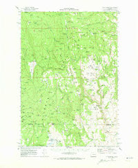
~ Flag Prairie OR topo map, 1:62500 scale, 15 X 15 Minute, Historical, 1970, updated 1973
Flag Prairie, Oregon, USGS topographic map dated 1970.
Includes geographic coordinates (latitude and longitude). This topographic map is suitable for hiking, camping, and exploring, or framing it as a wall map.
Printed on-demand using high resolution imagery, on heavy weight and acid free paper, or alternatively on a variety of synthetic materials.
Topos available on paper, Waterproof, Poly, or Tyvek. Usually shipping rolled, unless combined with other folded maps in one order.
- Product Number: USGS-5544686
- Free digital map download (high-resolution, GeoPDF): Flag Prairie, Oregon (file size: 8 MB)
- Map Size: please refer to the dimensions of the GeoPDF map above
- Weight (paper map): ca. 55 grams
- Map Type: POD USGS Topographic Map
- Map Series: HTMC
- Map Verison: Historical
- Cell ID: 54159
- Scan ID: 282498
- Imprint Year: 1973
- Woodland Tint: Yes
- Aerial Photo Year: 1969
- Field Check Year: 1970
- Datum: NAD27
- Map Projection: Polyconic
- Map published by United States Geological Survey
- Map Language: English
- Scanner Resolution: 600 dpi
- Map Cell Name: Flag Prairie
- Grid size: 15 X 15 Minute
- Date on map: 1970
- Map Scale: 1:62500
- Geographical region: Oregon, United States
Neighboring Maps:
All neighboring USGS topo maps are available for sale online at a variety of scales.
Spatial coverage:
Topo map Flag Prairie, Oregon, covers the geographical area associated the following places:
- Mud Flat Reservoir - Moffitt Spring - Antelope Mountain - Root Spring - Leacy Spring - Alder Spring - Buck Trough Spring - Lost Spring - South Fork Elk Creek - Bear Creek - Buttermilk Flat - Alder Creek - Cat Creek - Halfway Creek - Skagway Creek - Shorty Reservoir - Blue Bucket Cow Camp - Kate Creek - Little Malheur River Recreation Site - Red Hill Spring - Dead Horse Reservoir - Flag Prairie Cow Camp - Crane Creek - Miller and Jackson Spring - Palmer Spring - Tureman Spring - Kooney Spring - Cold Spring - Little Crane Creek - Barnett Spring - Hawkins Spring - Burke Spring - Tuck Reservoir - Pine Tree Spring - Aspen Spring - Skagway Reservoir - Tamarack Creek - North Fork Cow Camp - Breaks Reservoir - Lava Spring - Teepee Spring - Fir Tree Spring - Antelope Lookout Tower - Bear Creek Meadow - Flag Prairie - Bingham Spring - Turner Spring - Alder Spring - Buttermilk Creek - Sagehen Gulch - Stink Creek - Gib Spring - Crane Prairie Guard Station - Barrel Spring - Hoffman Spring - Little Crane Recreation Site - Rimrock Spring - Buck Spring - Alarm Clock Spring - L and H Spring - Sidehill Spring - Cougar Spring - North Fork Malheur Recreation Site - Sheep Gulch - TJW Reservoir - Roaring Spring - Smith Canyon - Mahogany Spring - Cabin Spring - Anderson Spring - Sixtynine Reservoir - Pine Tree Spring - Tongue Gulch - Lost Dog Gulch - Cougar Creek - Whitney Spring - Summit Rock - Lightning Spring - Telephone Gulch - Winegar Spring - Lost Spring - Happy Canyon - Canteen Creek - Lost Dog Flat - Chalk Reservoir - Cougar Meadow - Elk Creek Recreation Site - Swale Springs - Marksbury Spring - McKenzie Spring - Cottonwood Spring - Cruiser Spring - Monkey Run - Crane Creek Campground - Raw Dog Creek - Station Spring - Crane Prairie - Knox Meadow - Slate Gulch - Powder Spring Reservoir
- Map Area ID: AREA44.2544-118.5-118.25
- Northwest corner Lat/Long code: USGSNW44.25-118.5
- Northeast corner Lat/Long code: USGSNE44.25-118.25
- Southwest corner Lat/Long code: USGSSW44-118.5
- Southeast corner Lat/Long code: USGSSE44-118.25
- Northern map edge Latitude: 44.25
- Southern map edge Latitude: 44
- Western map edge Longitude: -118.5
- Eastern map edge Longitude: -118.25


