
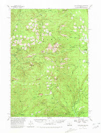
~ Echo Mountain OR topo map, 1:62500 scale, 15 X 15 Minute, Historical, 1955, updated 1980
Echo Mountain, Oregon, USGS topographic map dated 1955.
Includes geographic coordinates (latitude and longitude). This topographic map is suitable for hiking, camping, and exploring, or framing it as a wall map.
Printed on-demand using high resolution imagery, on heavy weight and acid free paper, or alternatively on a variety of synthetic materials.
Topos available on paper, Waterproof, Poly, or Tyvek. Usually shipping rolled, unless combined with other folded maps in one order.
- Product Number: USGS-5544582
- Free digital map download (high-resolution, GeoPDF): Echo Mountain, Oregon (file size: 9 MB)
- Map Size: please refer to the dimensions of the GeoPDF map above
- Weight (paper map): ca. 55 grams
- Map Type: POD USGS Topographic Map
- Map Series: HTMC
- Map Verison: Historical
- Cell ID: 53717
- Scan ID: 282446
- Imprint Year: 1980
- Woodland Tint: Yes
- Aerial Photo Year: 1954
- Field Check Year: 1955
- Datum: NAD27
- Map Projection: Polyconic
- Map published by United States Geological Survey
- Map Language: English
- Scanner Resolution: 600 dpi
- Map Cell Name: Echo Mountain
- Grid size: 15 X 15 Minute
- Date on map: 1955
- Map Scale: 1:62500
- Geographical region: Oregon, United States
Neighboring Maps:
All neighboring USGS topo maps are available for sale online at a variety of scales.
Spatial coverage:
Topo map Echo Mountain, Oregon, covers the geographical area associated the following places:
- Danny Creek - Quentin Creek - South Peak - Lost Prairie Recreation Site - Slide Creek - Burnside Creek - Lava Lake - House Rock Recreation Site - Fish Lake Recreation Site - Smith Prairie - North Peak - Crescent Mountain Trail - Conroy Creek - Olallie Creek Campground Boat Ramp - Fish Lake - Ice Cap Creek Recreation Site - Ikenick Creek - South Fork Park Creek - Cougar Creek - County Creek - Beaver Lakes - Carmen Diversion Dam - Crescent Mountain - Fish Lake Remount Depot - Wildcat Creek - Carmen Creek - Browder Ridge - Toad Creek - Mann Creek - Tombstone Prairie - Three Creek Trail - Latiwi Mountain - Snow Creek - Cadenza Creek - Carpenter Mountain - Beaver Marsh - Toll Creek - Maude Creek - Ram Creek - Smith Prairie Trail - Slipout Creek - Crazy Creek - Sweeney Creek - Cougar Lake - Brush Creek - The Parks - Cool Camp - Wolf Meadow - Hackleman Creek - Echo Mountain - Koosah Falls - Smith Dam - Smith River - Iron Mountain - Browder Creek - Olallie Recreation Site - Wolf Creek - Storm Creek - Trail Bridge Dam - Bunchgrass Mountain - Sweetwater Creek - Echo Creek - Latiwi Creek - South Pyramid - Olallie Creek - Browder Ridge Trail - Budworm Creek - Sevenmile Creek - Lamb Creek - Twelve Creek - Quentin Knob - Bunchgrass Creek - Lake Creek - Indian Creek - Payne Creek - Wildcat Mountain Research Area - Trail Bridge Recreation Site - Heart Lake - Wolf Rock - South Pyramid Creek - North Fork Cook Creek - North Fork Park Creek - Tamolitch Falls - Lakes End Campground - Kink Creek - Crescent Creek - Smith Reservoir Boat Ramp - Wildcat Mountain - Tommy Creek - Ethel Creek - Gate Creek - Dry Lake - Fish Lake Creek - Lost Prairie - Cone Peak - Cook Creek - Park Creek - Sheep Creek - Anderson Creek - Tombstone Pass
- Map Area ID: AREA44.544.25-122.25-122
- Northwest corner Lat/Long code: USGSNW44.5-122.25
- Northeast corner Lat/Long code: USGSNE44.5-122
- Southwest corner Lat/Long code: USGSSW44.25-122.25
- Southeast corner Lat/Long code: USGSSE44.25-122
- Northern map edge Latitude: 44.5
- Southern map edge Latitude: 44.25
- Western map edge Longitude: -122.25
- Eastern map edge Longitude: -122


