
~ Broken Top OR topo map, 1:62500 scale, 15 X 15 Minute, Historical, 1959, updated 1961
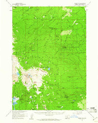
Broken Top, Oregon, USGS topographic map dated 1959.
Includes geographic coordinates (latitude and longitude). This topographic map is suitable for hiking, camping, and exploring, or framing it as a wall map.
Printed on-demand using high resolution imagery, on heavy weight and acid free paper, or alternatively on a variety of synthetic materials.
Topos available on paper, Waterproof, Poly, or Tyvek. Usually shipping rolled, unless combined with other folded maps in one order.
- Product Number: USGS-5544308
- Free digital map download (high-resolution, GeoPDF): Broken Top, Oregon (file size: 8 MB)
- Map Size: please refer to the dimensions of the GeoPDF map above
- Weight (paper map): ca. 55 grams
- Map Type: POD USGS Topographic Map
- Map Series: HTMC
- Map Verison: Historical
- Cell ID: 51815
- Scan ID: 282280
- Imprint Year: 1961
- Woodland Tint: Yes
- Aerial Photo Year: 1957
- Field Check Year: 1959
- Datum: NAD27
- Map Projection: Polyconic
- Map published by United States Geological Survey
- Map Language: English
- Scanner Resolution: 600 dpi
- Map Cell Name: Broken Top
- Grid size: 15 X 15 Minute
- Date on map: 1959
- Map Scale: 1:62500
- Geographical region: Oregon, United States
Neighboring Maps:
All neighboring USGS topo maps are available for sale online at a variety of scales.
Spatial coverage:
Topo map Broken Top, Oregon, covers the geographical area associated the following places:
- Farewell Spring - Happy Valley - Nordic Center - Soda Creek Recreation Site - Middle Fork Tumalo Creek - Bottle Creek - South Fork Whychus Creek - Swampy Lakes Trail - Bend City Water Intake - Cayuse Crater - Bend Glacier - Fall Creek Cabin - Swede Ridge Shelter - North Pole Creek - Demaris Lake - Todd Lake Recreation Site - Three Creek Meadow - Trout Creek Swamp - Fall Creek - Melvin Butte - Driftwood Recreation Site - Todd Lake - Lower Three Creek - Melvin Spring - Bearwallows - Little Three Creek Lake Dam - Park Meadow - Spruce Spring - Pole Creek Ditch - Broken Top Trail - Three Creek Meadow Horse Camp - Upper Three Creek Sno-Park - Park Creek - Three Creek - Bearwallow Butte - Melvin Creek - Swampy Lakes Shelter - Dutchman Sno-Park - North Fork Whychus Creek - Maxwell Ditch - Three Creek Lake - Broken Hand - Three Creek Meadow Recreation Site - Tam McArthur Rim - Tum Lake - Crater Creek Ditch - Triangle Hill - South Fork Shelter - Alder Creek - North Fork Tumalo Creek - Crater Creek - Black Pine Spring - Big Three Creek Lake Dam - Trout Creek Butte - Millican Crater - Little Crater Creek - Three Creek Butte - Jack Pine Spring - Todd Horse Camp - Green Lakes Trail - Tumalo Falls - Red Meadow - Little Three Creek Lake - Three Creek Lake Trail - Twin Meadows - Tam Lake - Bridge Creek - Cold Spring - Tumalo Lake - Swampy Lakes - Goose Creek - Sparks Lake - Egan Memorial Lodge (historical) - Soap Creek - East Fork Park Creek - Ball Butte - Corral Lake - Tumalo Falls Recreation Site - Tumalo Mountain - Chush Falls - Rim Lake - Crook Glacier - Pole Creek Swamp - Skyliner Sno-Park - Trapper Meadow Camp (historical) - Sparks Lake Boat Ramp - Golden Lake - Ditch Cabin - South Fork Tumalo Creek - Rock Creek - Soda Creek - Snow Creek - Three Creek Lake Recreation Site - West Village Lodge - Broken Top - West Fork Park Creek - Sparks Lake Recreation Site - Spring Creek - Soda Spring - Dutchman Flat
- Map Area ID: AREA44.2544-121.75-121.5
- Northwest corner Lat/Long code: USGSNW44.25-121.75
- Northeast corner Lat/Long code: USGSNE44.25-121.5
- Southwest corner Lat/Long code: USGSSW44-121.75
- Southeast corner Lat/Long code: USGSSE44-121.5
- Northern map edge Latitude: 44.25
- Southern map edge Latitude: 44
- Western map edge Longitude: -121.75
- Eastern map edge Longitude: -121.5


