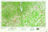
~ Dothan AL topo map, 1:250000 scale, 1 X 2 Degree, Historical, 1953, updated 1966
Dothan, Alabama, USGS topographic map dated 1953.
Includes geographic coordinates (latitude and longitude). This topographic map is suitable for hiking, camping, and exploring, or framing it as a wall map.
Printed on-demand using high resolution imagery, on heavy weight and acid free paper, or alternatively on a variety of synthetic materials.
Topos available on paper, Waterproof, Poly, or Tyvek. Usually shipping rolled, unless combined with other folded maps in one order.
- Product Number: USGS-5542875
- Free digital map download (high-resolution, GeoPDF): Dothan, Alabama (file size: 22 MB)
- Map Size: please refer to the dimensions of the GeoPDF map above
- Weight (paper map): ca. 55 grams
- Map Type: POD USGS Topographic Map
- Map Series: HTMC
- Map Verison: Historical
- Cell ID: 68752
- Scan ID: 305913
- Imprint Year: 1966
- Woodland Tint: Yes
- Edit Year: 1965
- Field Check Year: 1953
- Datum: Unstated
- Map Projection: Transverse Mercator
- Map published by United States Army Corps of Engineers
- Map published by United States Army
- Map Language: English
- Scanner Resolution: 600 dpi
- Map Cell Name: Dothan
- Grid size: 1 X 2 Degree
- Date on map: 1953
- Map Scale: 1:250000
- Geographical region: Alabama, United States
Neighboring Maps:
All neighboring USGS topo maps are available for sale online at a variety of scales.
Spatial coverage:
Topo map Dothan, Alabama, covers the geographical area associated the following places:
- Baker Heights - Wiregrass Hills - Eastgate - Josie - Dill - Bellview - Pinedale Estates - Dobbs Subdivision - Taylor - Stocks - Blues Old Stand - Country Estates - Edwards (historical) - Pachitla - Hoboken - Days Crossroads - Cotton - Centerville - Sawhatchee - Akridge (historical) - Garden Hill - Lakewood Estates - Crossroads - Woodsvale - Forest Park - Wildwood Mobile Home Park - Oakdale - Parish - Harrisons Mill - Byrd Subdivision - Browns Crossroad - Scottsdale Heights - Hillcrest - Daleville - Cottondale - Tumbleton - Water Pipe - Nicholasville (historical) - Fairfield - Waterford - Shady Heights - Brookhollow - Douglass Crossroads - Lugo - Barnes - Rolling Groves - Walters - Monticello - Pickett - Northend Addition - Avondale - Flintland - Palms Mobile Home Park - Dixieland - Cottondale - Logton - Philema - Sullivan Heights - Bottsford - Lamont Court - Sasser - High Bluff - Pleasant Hill (historical) - Frisco - Parkers (historical) - East Gate Estates - Shackleford Place - Lime Sink - Pointe South Mobile Estates - Level Plains - Jeff - Willow Bend - Mimsville - Five Points - Pecan - Chateau Estates - Audubon - Laney - Marl - Nutview (historical) - Lowry Mill - Dosaga - Big Eddy (historical) - Hollywood - Pointe North - Texasville - Oakland - East Towne - Jones Crossroads - Rowena - Jonesville - Mullins - Millville (historical) - Sandy Point - Town and Country Estates - Caldwell Subdivision - Rolling Acres - Neyami - Chickasawhatchee - Terry Crossroads
- Map Area ID: AREA3231-86-84
- Northwest corner Lat/Long code: USGSNW32-86
- Northeast corner Lat/Long code: USGSNE32-84
- Southwest corner Lat/Long code: USGSSW31-86
- Southeast corner Lat/Long code: USGSSE31-84
- Northern map edge Latitude: 32
- Southern map edge Latitude: 31
- Western map edge Longitude: -86
- Eastern map edge Longitude: -84

