
~ Bath ME topo map, 1:250000 scale, 1 X 2 Degree, Historical, 1948, updated 1951
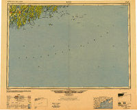
Bath, Maine, USGS topographic map dated 1948.
Includes geographic coordinates (latitude and longitude). This topographic map is suitable for hiking, camping, and exploring, or framing it as a wall map.
Printed on-demand using high resolution imagery, on heavy weight and acid free paper, or alternatively on a variety of synthetic materials.
Topos available on paper, Waterproof, Poly, or Tyvek. Usually shipping rolled, unless combined with other folded maps in one order.
- Product Number: USGS-5537439
- Free digital map download (high-resolution, GeoPDF): Bath, Maine (file size: 19 MB)
- Map Size: please refer to the dimensions of the GeoPDF map above
- Weight (paper map): ca. 55 grams
- Map Type: POD USGS Topographic Map
- Map Series: HTMC
- Map Verison: Historical
- Cell ID: 68663
- Scan ID: 806493
- Imprint Year: 1951
- Woodland Tint: Yes
- Aerial Photo Year: 1940
- Datum: NAD27
- Map Projection: Transverse Mercator
- Map published by United States Army Corps of Engineers
- Map published by United States Army
- Map Language: English
- Scanner Resolution: 508 dpi
- Map Cell Name: Bath
- Grid size: 1 X 2 Degree
- Date on map: 1948
- Map Scale: 1:250000
- Geographical region: Maine, United States
Neighboring Maps:
All neighboring USGS topo maps are available for sale online at a variety of scales.
Spatial coverage:
Topo map Bath, Maine, covers the geographical area associated the following places:
- Spruce Shores - Boothbay Harbor - Pine Cliff - Linnhaven West - West Point - Martinsville - Small Point Beach - Monhegan - Ashdale - Brunswick - West Georgetown - New Harbor - Gumet (historical) - Phippsburg - West Bristol - Wynburg (historical) - Pools Landing - West Boothbay Harbor - Parker Head - Pemaquid Beach - Boothbay - Cathance - Five Islands - North Edgecomb - Winnegance - Bailey Island - East Harpswell - Tenants Harbor - South Bristol - Round Pond - Linekin - South Cushing - Oak Hill - Dyer Corner - East Edgecomb - Pennellville - Westport - Port Clyde - Southport - Mount Pisgah - Pemaquid Harbor - Hendricks Harbor - Pemaquid Point - Walpole - Elmore - Ocean Point - Newagen - Yellow Head - Marrtown - North Harpswell - Harding - Glenmere - Martin - Montsweag - Pemaquid - Bay Point - Arrowsic - Dyer Cove - Bristol - Sabino - Trevett - East Boothbay - Mouse Island - Loudville - Matinicus - Harpswell Center - Heron Island - Edgecomb - Woolwich - Bath - Christmas Cove - Fort Edgecomb - Robinhood - Criehaven - Cundys Harbor - Fort Popham - Nequasset - Long Cove - Pemaquid (historical) - Popham Beach - Bayville - Days Ferry - Pleasant Point - Small Point - North Meadows - Brightwater - Meadowbrook - Chamberlain - Murphys Corner - Dover - Nequsset (historical) - Friendship - Muscongus - Merrymeeting Trailer Park - Spruceworld - MacMahan - West Southport - Perry Cove - Fort Baldwin - Orrs Island
- Map Area ID: AREA4443-70-68
- Northwest corner Lat/Long code: USGSNW44-70
- Northeast corner Lat/Long code: USGSNE44-68
- Southwest corner Lat/Long code: USGSSW43-70
- Southeast corner Lat/Long code: USGSSE43-68
- Northern map edge Latitude: 44
- Southern map edge Latitude: 43
- Western map edge Longitude: -70
- Eastern map edge Longitude: -68


