
~ Bar Harbor ME topo map, 1:100000 scale, 30 X 60 Minute, Historical, 1985, updated 1985
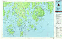
Bar Harbor, Maine, USGS topographic map dated 1985.
Includes geographic coordinates (latitude and longitude). This topographic map is suitable for hiking, camping, and exploring, or framing it as a wall map.
Printed on-demand using high resolution imagery, on heavy weight and acid free paper, or alternatively on a variety of synthetic materials.
Topos available on paper, Waterproof, Poly, or Tyvek. Usually shipping rolled, unless combined with other folded maps in one order.
- Product Number: USGS-5537331
- Free digital map download (high-resolution, GeoPDF): Bar Harbor, Maine (file size: 29 MB)
- Map Size: please refer to the dimensions of the GeoPDF map above
- Weight (paper map): ca. 55 grams
- Map Type: POD USGS Topographic Map
- Map Series: HTMC
- Map Verison: Historical
- Cell ID: 67096
- Scan ID: 807773
- Imprint Year: 1985
- Woodland Tint: Yes
- Aerial Photo Year: 1983
- Edit Year: 1985
- Datum: NAD27
- Map Projection: Universal Transverse Mercator
- Planimetric: Yes
- Map published by United States Geological Survey
- Map Language: English
- Scanner Resolution: 508 dpi
- Map Cell Name: Bar Harbor
- Grid size: 30 X 60 Minute
- Date on map: 1985
- Map Scale: 1:100000
- Geographical region: Maine, United States
Neighboring Maps:
All neighboring USGS topo maps are available for sale online at a variety of scales.
Spatial coverage:
Topo map Bar Harbor, Maine, covers the geographical area associated the following places:
- South Blue Hill - West Deer Isle - Surry - East Surry - Lamoine Corner - West Penobscot - Grays Corner - Harborside - Hall Quarry - Dark Harbor - Marlboro - Penobscot - East Blue Hill - Bayside - Red Rock Corner - Frenchboro - Prospect Harbor - Flat Landing - West Tremont - Tremont - Stonington - Sorrento - Summer Harbor - Pulpit Harbor - Seawall - Manset - Gouldsboro - Winter Harbor - Asticou - Richtown - Cape Rosier - Minturn - Crows Nest - Atlantic - Penobscot (historical) - North Castine - Ashville - Bass Harbor - Haven - Lamoine Beach - Temple Heights - Birch Harbor - Goose Falls - North Brooksville - West Trenton - Center - South Gouldsboro - North Islesboro - Stockton Springs - Blue Hill - Seal Harbor - Herricks - Swans Island - Sargentville - East Lamoine - North Haven - Pretty Marsh - South Brooksville - North Deer Isle - Brooklin - Richs Corner - Reach - Gerrishville - Islesboro - Hulls Cove - Bayside - South Penobscot - Sunshine - Cranberry Isles - Trenton - West Brooksville - North Sedgwick - Seal Cove - Somesville - East Northport - South Deer Isle - Sunset - Southwest Harbor - Naskeag - Norumbega - Stover Corner - Little Deer Isle - Otter Creek - Hancock Point - Deer Isle - Eggemoggin - South Surry - Searsport - Brooksville - Vinalhaven - Bar Harbor - Black Corner - Baldwin Corners - Indian Point - Town Hill - Oceanville - West Brooklin - Oak Hill - Eden - Northeast Harbor
- Map Area ID: AREA44.544-69-68
- Northwest corner Lat/Long code: USGSNW44.5-69
- Northeast corner Lat/Long code: USGSNE44.5-68
- Southwest corner Lat/Long code: USGSSW44-69
- Southeast corner Lat/Long code: USGSSE44-68
- Northern map edge Latitude: 44.5
- Southern map edge Latitude: 44
- Western map edge Longitude: -69
- Eastern map edge Longitude: -68


