
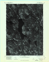
~ Anson NW ME topo map, 1:24000 scale, 7.5 X 7.5 Minute, Historical, 1975, updated 1980
Anson NW, Maine, USGS topographic map dated 1975.
Includes geographic coordinates (latitude and longitude). This topographic map is suitable for hiking, camping, and exploring, or framing it as a wall map.
Printed on-demand using high resolution imagery, on heavy weight and acid free paper, or alternatively on a variety of synthetic materials.
Topos available on paper, Waterproof, Poly, or Tyvek. Usually shipping rolled, unless combined with other folded maps in one order.
- Product Number: USGS-5533013
- Free digital map download (high-resolution, GeoPDF): Anson NW, Maine (file size: 10 MB)
- Map Size: please refer to the dimensions of the GeoPDF map above
- Weight (paper map): ca. 55 grams
- Map Type: POD USGS Topographic Map
- Map Series: HTMC
- Map Verison: Historical
- Cell ID: 14257
- Scan ID: 806459
- Imprint Year: 1980
- Aerial Photo Year: 1975
- Datum: NAD27
- Map Projection: Transverse Mercator
- Orthophoto: Quad
- Map published by United States Geological Survey
- Keywords: Nonstandard Press Run
- Map Language: English
- Scanner Resolution: 508 dpi
- Map Cell Name: Embden Pond
- Grid size: 7.5 X 7.5 Minute
- Date on map: 1975
- Map Scale: 1:24000
- Geographical region: Maine, United States
Neighboring Maps:
All neighboring USGS topo maps are available for sale online at a variety of scales.
Spatial coverage:
Topo map Anson NW, Maine, covers the geographical area associated the following places:
- Hilton Brook - Sandy Pond - Martin Stream - Hancock Stream - Boynton Pond - Black Hill Pond - Fahi Pond Dam - Old Bluff Mountain - Ela Rearing Station - Hutchins Brook - Hancock Pond - Embden Pond - Fahi Pond - Town of Embden - Deveraux Camps (historical) - Embden Elementary School (historical) - North New Portland Fairgrounds - Savage Hill Cemetery - Emerson School (historical) - Hancock Pond - Savage Hill - Black Hill - Mud Pond - Hunniwell Brook - Dunbar Hill - Witham Brook - Embden Pond Dam - Black Hill Stream - Concord Corner Cemetery - Hancock Pond Dam
- Map Area ID: AREA4544.875-70-69.875
- Northwest corner Lat/Long code: USGSNW45-70
- Northeast corner Lat/Long code: USGSNE45-69.875
- Southwest corner Lat/Long code: USGSSW44.875-70
- Southeast corner Lat/Long code: USGSSE44.875-69.875
- Northern map edge Latitude: 45
- Southern map edge Latitude: 44.875
- Western map edge Longitude: -70
- Eastern map edge Longitude: -69.875


