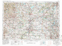
~ Rockford IL topo map, 1:250000 scale, 1 X 2 Degree, Historical, 1958, updated 1981
Rockford, Illinois, USGS topographic map dated 1958.
Includes geographic coordinates (latitude and longitude). This topographic map is suitable for hiking, camping, and exploring, or framing it as a wall map.
Printed on-demand using high resolution imagery, on heavy weight and acid free paper, or alternatively on a variety of synthetic materials.
Topos available on paper, Waterproof, Poly, or Tyvek. Usually shipping rolled, unless combined with other folded maps in one order.
- Product Number: USGS-5532965
- Free digital map download (high-resolution, GeoPDF): Rockford, Illinois (file size: 24 MB)
- Map Size: please refer to the dimensions of the GeoPDF map above
- Weight (paper map): ca. 55 grams
- Map Type: POD USGS Topographic Map
- Map Series: HTMC
- Map Verison: Historical
- Cell ID: 68990
- Scan ID: 310183
- Imprint Year: 1981
- Woodland Tint: Yes
- Aerial Photo Year: 1978
- Edit Year: 1980
- Field Check Year: 1958
- Datum: NAD27
- Map Projection: Transverse Mercator
- Map published by United States Geological Survey
- Map published by: Military, Other
- Map Language: English
- Scanner Resolution: 600 dpi
- Map Cell Name: Rockford
- Grid size: 1 X 2 Degree
- Date on map: 1958
- Map Scale: 1:250000
- Geographical region: Illinois, United States
Neighboring Maps:
All neighboring USGS topo maps are available for sale online at a variety of scales.
Spatial coverage:
Topo map Rockford, Illinois, covers the geographical area associated the following places:
- Lena - Long Grove Valley - Epplyanna - Park Meadowlands West Mobile Home Court - Stoughton - Burlington - Verona - Allens Grove - Elmwood - Wonder Center - Herons Crossing - Westmoreland - Swisshaven Mobile Home Park - Round Lake Park - Delavan - Canyon Ridge - Rue Vallee - Loves Park - Postville - North Shore - Caldwell - Buena Vista - Afton - Haegers Bend - Winslow - Bowers - Riley - Eagleville - Inlet - Davis - Turtleville - Mineral Point - Koshkonong - Marden Estates - Myrtle - Lakemoor - Armsby (historical) - Heath Mills - Genesee Depot - Riverwood Estates - Byron Hills Estates - Lloyd Whale Subdivision - Ingleside - Herbert - Squires - Freeport - Lake Zurich Manor - Woodford - Hanerville - Volo - Oakbrook Estates Mobile Home Park - Florence - North Park - New Glarus - Starks - Shady Nook Mobile Home Park - Riverdale - Hunt Corners - Durand - Owen Center - Hilburn - McHenry - Browns Mill - Lake Como - Rockford Mobile Home Park - Footville - Cooksville - Twin Lakes - Timber Trails - Grant Park - Wilkinson - Davis Junction - Exeter - Kneeland - Forward - Rochester - Ross Crossing - Clinton - Schaumburg - Beloit - Colvin Park - Wilson - Ancient Oaks - White Rock - Hickory View Estates - Johnstown - Fox Point North - Genoa - Pine Valley - Atwood Estates - Spring Valley - Belcrest - Oregon - Harper - Island Lake - Genoa City - Salem - Linton - Afolkey - Greenview Estates
- Map Area ID: AREA4342-90-88
- Northwest corner Lat/Long code: USGSNW43-90
- Northeast corner Lat/Long code: USGSNE43-88
- Southwest corner Lat/Long code: USGSSW42-90
- Southeast corner Lat/Long code: USGSSE42-88
- Northern map edge Latitude: 43
- Southern map edge Latitude: 42
- Western map edge Longitude: -90
- Eastern map edge Longitude: -88

