
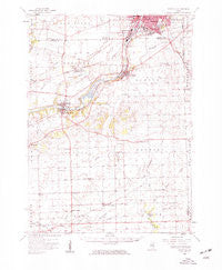
~ Yorkville IL topo map, 1:62500 scale, 15 X 15 Minute, Historical, 1954, updated 1959
Yorkville, Illinois, USGS topographic map dated 1954.
Includes geographic coordinates (latitude and longitude). This topographic map is suitable for hiking, camping, and exploring, or framing it as a wall map.
Printed on-demand using high resolution imagery, on heavy weight and acid free paper, or alternatively on a variety of synthetic materials.
Topos available on paper, Waterproof, Poly, or Tyvek. Usually shipping rolled, unless combined with other folded maps in one order.
- Product Number: USGS-5532795
- Free digital map download (high-resolution, GeoPDF): Yorkville, Illinois (file size: 7 MB)
- Map Size: please refer to the dimensions of the GeoPDF map above
- Weight (paper map): ca. 55 grams
- Map Type: POD USGS Topographic Map
- Map Series: HTMC
- Map Verison: Historical
- Cell ID: 64805
- Scan ID: 310091
- Imprint Year: 1959
- Woodland Tint: Yes
- Aerial Photo Year: 1952
- Survey Year: 1954
- Datum: NAD27
- Map Projection: Polyconic
- Map published by United States Geological Survey
- Map Language: English
- Scanner Resolution: 600 dpi
- Map Cell Name: Yorkville
- Grid size: 15 X 15 Minute
- Date on map: 1954
- Map Scale: 1:62500
- Geographical region: Illinois, United States
Neighboring Maps:
All neighboring USGS topo maps are available for sale online at a variety of scales.
Spatial coverage:
Topo map Yorkville, Illinois, covers the geographical area associated the following places:
- Ponds At Mill Race Creek - River Run - South Park - Deerpath Creek - Farmington Lakes - Tamarack - Fox Chase - Oswego Village Square - Boulder Hill - Lakeview Estates - Brighton Meadows - Winding Waters Of Mill Race Creek - Steeplechase At Churchill Club - Deerpath Trails - Wheatland Plains - Springbrook At Farmington Lakes - Brookside Manor - Gates Creek - Ashcroft Place - River Mist On The Fox - Yorkville - Arbor Gate - Wolfs - Montgomery - Plattville - White Pines - Lakeview Estates West - Hunters Ridge - Blackberry Knoll - Park Place - Pavillion - Countryside - Cedar Glen - Helmar - Ashcroft - Morgan Crossing - Estates Of Fox Chase - Ament Corners - Southbury - Knob Hill - Windcrest - Lynwood - Fox - Victoria Meadows - Oswego - Bristol - Mill Race Creek - Gates Creek West - Kentland - Scraper-Moecherville - Old Reserve Hills - Lisbon Center
- Map Area ID: AREA41.7541.5-88.5-88.25
- Northwest corner Lat/Long code: USGSNW41.75-88.5
- Northeast corner Lat/Long code: USGSNE41.75-88.25
- Southwest corner Lat/Long code: USGSSW41.5-88.5
- Southeast corner Lat/Long code: USGSSE41.5-88.25
- Northern map edge Latitude: 41.75
- Southern map edge Latitude: 41.5
- Western map edge Longitude: -88.5
- Eastern map edge Longitude: -88.25


