
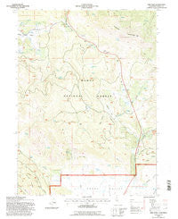
~ Adin Pass CA topo map, 1:24000 scale, 7.5 X 7.5 Minute, Historical, 1993, updated 1996
Adin Pass, California, USGS topographic map dated 1993.
Includes geographic coordinates (latitude and longitude). This topographic map is suitable for hiking, camping, and exploring, or framing it as a wall map.
Printed on-demand using high resolution imagery, on heavy weight and acid free paper, or alternatively on a variety of synthetic materials.
Topos available on paper, Waterproof, Poly, or Tyvek. Usually shipping rolled, unless combined with other folded maps in one order.
- Product Number: USGS-5507131
- Free digital map download (high-resolution, GeoPDF): Adin Pass, California (file size: 11 MB)
- Map Size: please refer to the dimensions of the GeoPDF map above
- Weight (paper map): ca. 55 grams
- Map Type: POD USGS Topographic Map
- Map Series: HTMC
- Map Verison: Historical
- Cell ID: 69112
- Scan ID: 287810
- Imprint Year: 1996
- Woodland Tint: Yes
- Aerial Photo Year: 1988
- Field Check Year: 1993
- Datum: NAD27
- Map Projection: Lambert Conformal Conic
- Map published by United States Forest Service
- Map Language: English
- Scanner Resolution: 600 dpi
- Map Cell Name: Adin Pass
- Grid size: 7.5 X 7.5 Minute
- Date on map: 1993
- Map Scale: 1:24000
- Geographical region: California, United States
Neighboring Maps:
All neighboring USGS topo maps are available for sale online at a variety of scales.
Spatial coverage:
Topo map Adin Pass, California, covers the geographical area associated the following places:
- Roney Flat - Rice Spring - Schaffer Mountain - The Cliffs - Higgins Flat - Ryan Ridge - Niles Spring - Niles Flat - Plum Spring - Harper Spring - Antelope Spring - Adin Pass - Quail Spring - Cox Canyon - Niles Canyon - Hoskins Spring - Schaffer Spring - McClure Spring - Fork Spring - Haw Spring - Rice Flat - Conklin Spring - Post Canyon - Rice Springs - Dutch Flat Canyon - Lost Cabin Mine - Adin Summit Pond - Harris Spring - Conklin Sawmill (historical) - Bennett Canyon - Shake Spring - Higgins Canyon - Lower Rush Creek Campground - Horse Springs - Johnson Creek
- Map Area ID: AREA41.37541.25-121-120.875
- Northwest corner Lat/Long code: USGSNW41.375-121
- Northeast corner Lat/Long code: USGSNE41.375-120.875
- Southwest corner Lat/Long code: USGSSW41.25-121
- Southeast corner Lat/Long code: USGSSE41.25-120.875
- Northern map edge Latitude: 41.375
- Southern map edge Latitude: 41.25
- Western map edge Longitude: -121
- Eastern map edge Longitude: -120.875


