
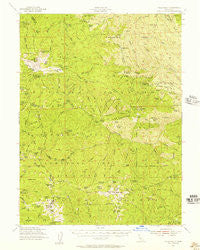
~ Yolla Bolly CA topo map, 1:62500 scale, 15 X 15 Minute, Historical, 1954, updated 1957
Yolla Bolly, California, USGS topographic map dated 1954.
Includes geographic coordinates (latitude and longitude). This topographic map is suitable for hiking, camping, and exploring, or framing it as a wall map.
Printed on-demand using high resolution imagery, on heavy weight and acid free paper, or alternatively on a variety of synthetic materials.
Topos available on paper, Waterproof, Poly, or Tyvek. Usually shipping rolled, unless combined with other folded maps in one order.
- Product Number: USGS-5505183
- Free digital map download (high-resolution, GeoPDF): Yolla Bolly, California (file size: 9 MB)
- Map Size: please refer to the dimensions of the GeoPDF map above
- Weight (paper map): ca. 55 grams
- Map Type: POD USGS Topographic Map
- Map Series: HTMC
- Map Verison: Historical
- Cell ID: 64798
- Scan ID: 302023
- Imprint Year: 1957
- Woodland Tint: Yes
- Aerial Photo Year: 1944
- Field Check Year: 1954
- Datum: NAD27
- Map Projection: Polyconic
- Map published by United States Geological Survey
- Map published by United States Forest Service
- Map Language: English
- Scanner Resolution: 600 dpi
- Map Cell Name: Yolla Bolly
- Grid size: 15 X 15 Minute
- Date on map: 1954
- Map Scale: 1:62500
- Geographical region: California, United States
Neighboring Maps:
All neighboring USGS topo maps are available for sale online at a variety of scales.
Spatial coverage:
Topo map Yolla Bolly, California, covers the geographical area associated the following places:
- Grouse Ridge - Lazyman Butte - Fish Ridge - Slides Ridge - South Yolla Bolly Mountains - Lazyman Butte Trail - Johnson Headquarters - Post Creek - Opium Glade Ridge - Jones Camp Creek - Manzanita Ridge - Minnie Lake - North Yolla Bolly Spring - Robinson Creek - Raney Peak - Iron Spring - Barker Camp - Tomhead Mine - Iron Spring Gulch - Hopkins Peak - Appletree Glade - Tomhead Spring - Oven Lid - Stuart Gap - Mount Linn - North Yolla Bolly Spring - North Yolla Bolly Guard Station - Toomes Camp - Rat Trap Gap - Hopkins Hollow - Burnt Canyon - Van Spring - Sulphur Creek - Cedar Basin - Devils Hole Gulch - North Yolla Bolly Mountains - Rat Trap Gap Trailhead Parking - Browns Camp Trailhead - Horsepacker Trailhead - Tedoc Mountain - Switzel-Baum Creek - Plum Garden - Hog Gulch - Twin Peaks - Slides Glade - Deer Creek - Ides Cove - Browns Camp - Spring Rock - Iron Spring Ridge - Prine Cabin - Cedar Creek - Vinegar Peak - Tedoc Gap - Pettijohn Trail - Long Ridge Trail - Dead Horse Ridge - Beegum Basin - Weston Ranch - Thomes Pocket Recreation Site - Post Creek Guard Station - North Yolla Bolly Lake - Sanders Place - Willow Basin - Hole-in-the-Ground - Tomhead Mountain Lookout - Burnt Camp - Wells Creek Campground - Ides Cove National Recreation Trail - Clarence Spring - Middle Ridge - Devils Hole - Van Spring Gulch - Devils Hole Ridge Trail - Digger Creek - Square Lake - Kingsley Lake - Deer Ridge - Harvey Ridge - Buck Camp - Greasewood Basin - Stinking Springs - Lone Pine Spring - Sheep Trail Gulch - Rat Trap Gap Trailhead - Thunder Camp - Toomes Camp - Sulphur Spring - Mullen Gulch - Trough Spring Ridge - Hammerhorn Mountain - Cedar Basin - Tomhead Mountain - Cox Glade - South Yolla Bolly - Grasshoppers Camp - Chicago Spring - Buck Creek - Rat Trap Ridge - Nuisance Ridge
- Map Area ID: AREA40.2540-123-122.75
- Northwest corner Lat/Long code: USGSNW40.25-123
- Northeast corner Lat/Long code: USGSNE40.25-122.75
- Southwest corner Lat/Long code: USGSSW40-123
- Southeast corner Lat/Long code: USGSSE40-122.75
- Northern map edge Latitude: 40.25
- Southern map edge Latitude: 40
- Western map edge Longitude: -123
- Eastern map edge Longitude: -122.75


