
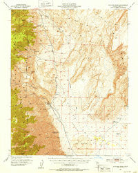
~ Waucoba Wash CA topo map, 1:62500 scale, 15 X 15 Minute, Historical, 1951, updated 1953
Waucoba Wash, California, USGS topographic map dated 1951.
Includes geographic coordinates (latitude and longitude). This topographic map is suitable for hiking, camping, and exploring, or framing it as a wall map.
Printed on-demand using high resolution imagery, on heavy weight and acid free paper, or alternatively on a variety of synthetic materials.
Topos available on paper, Waterproof, Poly, or Tyvek. Usually shipping rolled, unless combined with other folded maps in one order.
- Product Number: USGS-5505045
- Free digital map download (high-resolution, GeoPDF): Waucoba Wash, California (file size: 10 MB)
- Map Size: please refer to the dimensions of the GeoPDF map above
- Weight (paper map): ca. 55 grams
- Map Type: POD USGS Topographic Map
- Map Series: HTMC
- Map Verison: Historical
- Cell ID: 64296
- Scan ID: 301955
- Imprint Year: 1953
- Woodland Tint: Yes
- Aerial Photo Year: 1947
- Survey Year: 1951
- Datum: NAD27
- Map Projection: Polyconic
- Map published by United States Geological Survey
- Map Language: English
- Scanner Resolution: 600 dpi
- Map Cell Name: Waucoba Wash
- Grid size: 15 X 15 Minute
- Date on map: 1951
- Map Scale: 1:62500
- Geographical region: California, United States
Neighboring Maps:
All neighboring USGS topo maps are available for sale online at a variety of scales.
Spatial coverage:
Topo map Waucoba Wash, California, covers the geographical area associated the following places:
- Waucoba Canyon - Pick Up Prospect - Inyo Queen Number 1 Mine - Independence Claims - Inyo Mountains Wilderness - Lead Canyon - Willow Creek Camp - Lower Warm Springs - Blue Monster Mine - The Dunes - South Fork Willow Creek - Inyo Queen Number 2 Mine - White Eagle Talc Mine - Chicken Strip (historical) - North Fork Willow Creek - Pat Keyes Spring - Waucoba Mine - Bunker Hill Canyon - Lucky Boy Mine - Valley View Prospect - Independence Division - Addle Canyon - Badwater Springs - McElvoy Canyon - Paiute Canyon - Lucky Josephine Number 10 Prospect - Inyo King Prospect - Palm Spring - Pat Keyes Canyon - Custer Mine - Wheeler Canyon - Willow Creek - Grey Eagle Talc Mine - Mount Inyo - Bunker Hill Mine
- Map Area ID: AREA3736.75-118-117.75
- Northwest corner Lat/Long code: USGSNW37-118
- Northeast corner Lat/Long code: USGSNE37-117.75
- Southwest corner Lat/Long code: USGSSW36.75-118
- Southeast corner Lat/Long code: USGSSE36.75-117.75
- Northern map edge Latitude: 37
- Southern map edge Latitude: 36.75
- Western map edge Longitude: -118
- Eastern map edge Longitude: -117.75


