
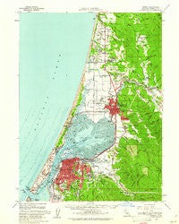
~ Eureka CA topo map, 1:62500 scale, 15 X 15 Minute, Historical, 1959, updated 1961
Eureka, California, USGS topographic map dated 1959.
Includes geographic coordinates (latitude and longitude). This topographic map is suitable for hiking, camping, and exploring, or framing it as a wall map.
Printed on-demand using high resolution imagery, on heavy weight and acid free paper, or alternatively on a variety of synthetic materials.
Topos available on paper, Waterproof, Poly, or Tyvek. Usually shipping rolled, unless combined with other folded maps in one order.
- Product Number: USGS-5501703
- Free digital map download (high-resolution, GeoPDF): Eureka, California (file size: 8 MB)
- Map Size: please refer to the dimensions of the GeoPDF map above
- Weight (paper map): ca. 55 grams
- Map Type: POD USGS Topographic Map
- Map Series: HTMC
- Map Verison: Historical
- Cell ID: 53976
- Scan ID: 297443
- Imprint Year: 1961
- Woodland Tint: Yes
- Aerial Photo Year: 1956
- Survey Year: 1959
- Datum: NAD27
- Map Projection: Polyconic
- Map published by United States Geological Survey
- Map Language: English
- Scanner Resolution: 600 dpi
- Map Cell Name: Eureka
- Grid size: 15 X 15 Minute
- Date on map: 1959
- Map Scale: 1:62500
- Geographical region: California, United States
Neighboring Maps:
All neighboring USGS topo maps are available for sale online at a variety of scales.
Spatial coverage:
Topo map Eureka, California, covers the geographical area associated the following places:
- Eureka - Bayview - Myrtletown - Sunny Brae - West Humboldt (historical) - Fisher - Fieldbrook - Freshwater - Ocean West Mobile Home Park - Eddyville (historical) - Fickle Hill - Rosewood - Arcata - Clam Beach - Bucksport - The Springs - Glendale - Bayside - Fairhaven - Essex - Cutten - Samoa - Manila - McKinleyville - Indianola - Brainard - Alliance - Freshwater Corners - Bracut - Calville - Korblex - Tyee City - Pine Hill
- Map Area ID: AREA4140.75-124.25-124
- Northwest corner Lat/Long code: USGSNW41-124.25
- Northeast corner Lat/Long code: USGSNE41-124
- Southwest corner Lat/Long code: USGSSW40.75-124.25
- Southeast corner Lat/Long code: USGSSE40.75-124
- Northern map edge Latitude: 41
- Southern map edge Latitude: 40.75
- Western map edge Longitude: -124.25
- Eastern map edge Longitude: -124


