
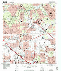
~ Satsuma TX topo map, 1:24000 scale, 7.5 X 7.5 Minute, Historical, 1995, updated 2000
Satsuma, Texas, USGS topographic map dated 1995.
Includes geographic coordinates (latitude and longitude). This topographic map is suitable for hiking, camping, and exploring, or framing it as a wall map.
Printed on-demand using high resolution imagery, on heavy weight and acid free paper, or alternatively on a variety of synthetic materials.
Topos available on paper, Waterproof, Poly, or Tyvek. Usually shipping rolled, unless combined with other folded maps in one order.
- Product Number: USGS-5493869
- Free digital map download (high-resolution, GeoPDF): Satsuma, Texas (file size: 12 MB)
- Map Size: please refer to the dimensions of the GeoPDF map above
- Weight (paper map): ca. 55 grams
- Map Type: POD USGS Topographic Map
- Map Series: HTMC
- Map Verison: Historical
- Cell ID: 40023
- Scan ID: 124018
- Imprint Year: 2000
- Woodland Tint: Yes
- Visual Version Number: 1
- Aerial Photo Year: 1995
- Datum: NAD83
- Map Projection: Universal Transverse Mercator
- Map published by United States Geological Survey
- Map Language: English
- Scanner Resolution: 600 dpi
- Map Cell Name: Satsuma
- Grid size: 7.5 X 7.5 Minute
- Date on map: 1995
- Map Scale: 1:24000
- Geographical region: Texas, United States
Neighboring Maps:
All neighboring USGS topo maps are available for sale online at a variety of scales.
Spatial coverage:
Topo map Satsuma, Texas, covers the geographical area associated the following places:
- Champion Park - Jersey Village - Winchester Country - Hastings Green - Cypress Glen - Champions East - Tower Oak Bend - Mill Ridge North - Hudson - Grantwood - Creekside Estates South - Huntwick Forest - Melendy - Satsuma - Woodland Trails North - Woodedge Village - Ravensway - Pedegrel Forest - Harvest Meadows - Cashel Forest - Bell Meads - Brookhollow West - Tower Oaks Meadows - Deco - Tallowwood - Greenwood Forest - Ravensway South - Norchester - Westbank - Northwest Green - Cypress Creek Estates - Northwest Park - Willowood - Tower Oaks - North Houston - Tower Oak Plaza - Barwood - Woodland Oaks - Cutten Green - Woods of Wimbledon - Windfern Forest - Turtle Lake - Canterbury Forest - Western Estates - Lakewood West - Sabacen Park
- Map Area ID: AREA3029.875-95.625-95.5
- Northwest corner Lat/Long code: USGSNW30-95.625
- Northeast corner Lat/Long code: USGSNE30-95.5
- Southwest corner Lat/Long code: USGSSW29.875-95.625
- Southeast corner Lat/Long code: USGSSE29.875-95.5
- Northern map edge Latitude: 30
- Southern map edge Latitude: 29.875
- Western map edge Longitude: -95.625
- Eastern map edge Longitude: -95.5


