
~ Arroyo Veleno TX topo map, 1:24000 scale, 7.5 X 7.5 Minute, Historical, 1980, updated 1980
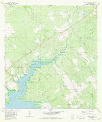
Arroyo Veleno, Texas, USGS topographic map dated 1980.
Includes geographic coordinates (latitude and longitude). This topographic map is suitable for hiking, camping, and exploring, or framing it as a wall map.
Printed on-demand using high resolution imagery, on heavy weight and acid free paper, or alternatively on a variety of synthetic materials.
Topos available on paper, Waterproof, Poly, or Tyvek. Usually shipping rolled, unless combined with other folded maps in one order.
- Product Number: USGS-5481783
- Free digital map download (high-resolution, GeoPDF): Arroyo Veleno, Texas (file size: 13 MB)
- Map Size: please refer to the dimensions of the GeoPDF map above
- Weight (paper map): ca. 55 grams
- Map Type: POD USGS Topographic Map
- Map Series: HTMC
- Map Verison: Historical
- Cell ID: 1558
- Scan ID: 106207
- Imprint Year: 1980
- Woodland Tint: Yes
- Visual Version Number: 1
- Aerial Photo Year: 1974
- Edit Year: 1980
- Field Check Year: 1975
- Datum: NAD27
- Map Projection: Lambert Conformal Conic
- Map published by United States Geological Survey
- Map Language: English
- Scanner Resolution: 600 dpi
- Map Cell Name: Arroyo Veleno
- Grid size: 7.5 X 7.5 Minute
- Date on map: 1980
- Map Scale: 1:24000
- Geographical region: Texas, United States
Neighboring Maps:
All neighboring USGS topo maps are available for sale online at a variety of scales.
Spatial coverage:
Topo map Arroyo Veleno, Texas, covers the geographical area associated the following places:
- Gutierrez Lake Number 2 - Gutierrez Lake Number 2 Dam - Villa Creek - Arroyo Dodier - Charco Tank - Arroyo Indio - Cañada Honda - Zapata County Airport - El Varal Tank - Salómoneno Creek - Arroyo Torcido - La Esquina Tank - Arroyo Plan de Barajas - El Medio Tank - El Rancho Tank - Hondo Tank - Arroyo Veleno - Gutierrez Lake Number 1 - Arroyo Costa Rica - Arroyo Cabeza de Vaca - Ranchito Tank - Arroyo Varal - Maestro Tank - Arroyo Humaran - Gutierrez Lake Number 1 Dam - Arroyo Blanco
- Map Area ID: AREA2726.875-99.25-99.125
- Northwest corner Lat/Long code: USGSNW27-99.25
- Northeast corner Lat/Long code: USGSNE27-99.125
- Southwest corner Lat/Long code: USGSSW26.875-99.25
- Southeast corner Lat/Long code: USGSSE26.875-99.125
- Northern map edge Latitude: 27
- Southern map edge Latitude: 26.875
- Western map edge Longitude: -99.25
- Eastern map edge Longitude: -99.125


