
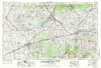
~ Big Spring TX topo map, 1:250000 scale, 1 X 2 Degree, Historical, 1954, updated 1984
Big Spring, Texas, USGS topographic map dated 1954.
Includes geographic coordinates (latitude and longitude). This topographic map is suitable for hiking, camping, and exploring, or framing it as a wall map.
Printed on-demand using high resolution imagery, on heavy weight and acid free paper, or alternatively on a variety of synthetic materials.
Topos available on paper, Waterproof, Poly, or Tyvek. Usually shipping rolled, unless combined with other folded maps in one order.
- Product Number: USGS-5480923
- Free digital map download (high-resolution, GeoPDF): Big Spring, Texas (file size: 18 MB)
- Map Size: please refer to the dimensions of the GeoPDF map above
- Weight (paper map): ca. 55 grams
- Map Type: POD USGS Topographic Map
- Map Series: HTMC
- Map Verison: Historical
- Cell ID: 68674
- Scan ID: 108194
- Imprint Year: 1984
- Woodland Tint: Yes
- Visual Version Number: 2
- Photo Revision Year: 1975
- Aerial Photo Year: 1974
- Edit Year: 1975
- Field Check Year: 1954
- Datum: NAD27
- Map Projection: Transverse Mercator
- Map published by: Military, Other
- Map Language: English
- Scanner Resolution: 600 dpi
- Map Cell Name: Big Spring
- Grid size: 1 X 2 Degree
- Date on map: 1954
- Map Scale: 1:250000
- Geographical region: Texas, United States
Neighboring Maps:
All neighboring USGS topo maps are available for sale online at a variety of scales.
Spatial coverage:
Topo map Big Spring, Texas, covers the geographical area associated the following places:
- Westbrook - Franklin Center - Hudd - Dermott - Midway - Pastura - Lomax - Rotan - Toland - Cuthbert - Merkel - Hyman - Knapp - Fisher - McCaulley - Avenger Village - Palava - Champion - Flower Grove - Coahoma - Midway - Vealmoor - Spade - Lees - Buford - Cross Roads - Three Leagues - Inadale - Hobbs - Old Houston Place - Roscoe - Snyder - Silver - Happy Valley - Center - Elbow - Gail - Blair - Knott - Hermleigh - Lowe - Longworth - Iolanthe (historical) - Flower Grove - Union - Luther - O'Donnell - Mesquite - Red Bluff Crossing - North Roby - Royston - Trent - Sanco - Grimes - Big Spring - Sylvester - Shaufler - Ira - Hamlin - Otis Chalk - Shep - South Haven - Hancock - Gannon - Reynolds - Colorado City - Bernecker - Key - Noodle - Morita - Fort Chadbourne - Roby - Blackwell - Maryneal - Brand - Orient - Grandview - Fullerville - Capitola - Hylton - Germania - Stanton - Fairview - Dunn - Sparenberg - Busby - Klondike - Grady - Sand Springs - Iatan - Eskota - Hindman - Webb Village - Ziler - Los Ybanez - Fivemile - Sweetwater - Arvana - Nolan - Tenmile
- Map Area ID: AREA3332-102-100
- Northwest corner Lat/Long code: USGSNW33-102
- Northeast corner Lat/Long code: USGSNE33-100
- Southwest corner Lat/Long code: USGSSW32-102
- Southeast corner Lat/Long code: USGSSE32-100
- Northern map edge Latitude: 33
- Southern map edge Latitude: 32
- Western map edge Longitude: -102
- Eastern map edge Longitude: -100


