
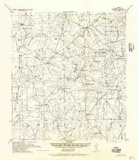
~ Becerra TX topo map, 1:62500 scale, 15 X 15 Minute, Historical, 1956
Becerra, Texas, USGS topographic map dated 1956.
Includes geographic coordinates (latitude and longitude). This topographic map is suitable for hiking, camping, and exploring, or framing it as a wall map.
Printed on-demand using high resolution imagery, on heavy weight and acid free paper, or alternatively on a variety of synthetic materials.
Topos available on paper, Waterproof, Poly, or Tyvek. Usually shipping rolled, unless combined with other folded maps in one order.
- Product Number: USGS-5478043
- Free digital map download (high-resolution, GeoPDF): Becerra, Texas (file size: 6 MB)
- Map Size: please refer to the dimensions of the GeoPDF map above
- Weight (paper map): ca. 55 grams
- Map Type: POD USGS Topographic Map
- Map Series: HTMC
- Map Verison: Historical
- Cell ID: 51087
- Scan ID: 105809
- Visual Version Number: 1
- Aerial Photo Year: 1936
- Field Check Year: 1937
- Datum: NAD
- Map Projection: Polyconic
- Map published by United States Army Corps of Engineers
- Keywords: Nonstandard Press Run
- Map Language: English
- Scanner Resolution: 600 dpi
- Map Cell Name: Alamito Creek
- Grid size: 15 X 15 Minute
- Date on map: 1956
- Map Scale: 1:62500
- Geographical region: Texas, United States
Neighboring Maps:
All neighboring USGS topo maps are available for sale online at a variety of scales.
Spatial coverage:
Topo map Becerra, Texas, covers the geographical area associated the following places:
- Nicholson Lake - Nunley Lake Dam - Nunley Lake Number 2 - Walker Lake Dam - Hirsh Ranch - Traylor Lake Number 2 - Nunley Lake Number 2 Dam - Colwell Lake Dam - Martinena Ranch Lake - Nicholson Lake Dam - Frank Nunley Lake - Frank Nunley Lake Dam - Carrizitos Creek - Alamito Creek - Colwell Lake Dam - Becerra Cemetery - Pato Creek - Venado Creek - Walker Lake - A P Ranch Airport (historical) - Abbott and Clapp Lake Dam - Mule Creek - Dolores Creek - Martinena Ranch Lake Dam - Traylor Lake Number 2 Dam - Abbott and Clapp Lake - Gato Creek - Nicholson Ranch Lake Number 2 - San Carlos Creek - Nicholson Ranch Lake Number 2 Dam - Dolores Creek - Nunley Lake
- Map Area ID: AREA2827.75-99.25-99
- Northwest corner Lat/Long code: USGSNW28-99.25
- Northeast corner Lat/Long code: USGSNE28-99
- Southwest corner Lat/Long code: USGSSW27.75-99.25
- Southeast corner Lat/Long code: USGSSE27.75-99
- Northern map edge Latitude: 28
- Southern map edge Latitude: 27.75
- Western map edge Longitude: -99.25
- Eastern map edge Longitude: -99


